File:Terschelling 5.35765E 53.40913N.jpg

Size o this luikower: 800 × 599 pixels. Ither resolutions: 320 × 240 pixels | 640 × 479 pixels | 1,024 × 766 pixels | 1,280 × 958 pixels.
Oreeginal file (1,280 × 958 pixels, file size: 121 KB, MIME type: image/jpeg)
Ootline
| Descreeption |
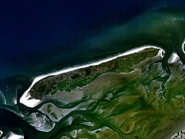
English: Terschelling, The Netherlands. Satellite view. |
| Date | 17 Mey 2005 (upload date) |
| Soorce | Satellite imagery taken from NASA World Wind software (by screenshot) |
| Author | NASA |
| Object location | | View this and other nearby images on: OpenStreetMap |
|---|
Licensin
| This image is in the public domain because it is a screenshot from NASA’s globe software World Wind using a public domain layer, such as Blue Marble, MODIS, Landsat, SRTM, USGS or GLOBE.
|
 |
File history
Clap oan ae date/time fer tae see the file aes it kithed at that time.
| Date/Time | Thummnail | Dimensions | Uiser | Comment | |
|---|---|---|---|---|---|
| current | 12:06, 17 Mey 2005 | | 1,280 × 958 (121 KB) | Rex | Terschelling, The Netherlands NASA World Wind screenshot. {{PD-USGov-NASA}} Category:Maps of the Netherlands |
Eimage airtins
The'r nae pages airts tae this eimage.
Global file uisage
The follaein ither wikis uise this file:
- Uisage on an.wikipedia.org
- Uisage on br.wikipedia.org
- Uisage on ca.wikipedia.org
- Uisage on ceb.wikipedia.org
- Uisage on de.wikipedia.org
- Uisage on en.wikipedia.org
- Uisage on eo.wikipedia.org
- Uisage on es.wikipedia.org
- Uisage on fa.wikipedia.org
- Uisage on fr.wikipedia.org
- Uisage on hak.wikipedia.org
- Uisage on he.wikipedia.org
- Uisage on hu.wikipedia.org
- Uisage on ja.wikipedia.org
- Uisage on ko.wikipedia.org
- Uisage on li.wikipedia.org
- Uisage on nds-nl.wikipedia.org
- Uisage on nl.wikipedia.org
- Uisage on nn.wikipedia.org
- Uisage on no.wikipedia.org
- Uisage on pl.wikipedia.org
- Uisage on pt.wikipedia.org
- Uisage on sv.wikipedia.org
- Uisage on uk.wikipedia.org
- Uisage on zh-min-nan.wikipedia.org
- Uisage on zh.wikipedia.org