File:Sweden location map.svg

Size of this PNG preview of this SVG file: 311 × 599 pixels. Ither resolutions: 124 × 240 pixels | 249 × 480 pixels | 399 × 768 pixels | 532 × 1,024 pixels | 1,064 × 2,048 pixels | 954 × 1,836 pixels.
Oreeginal file (SVG file, nominallie 954 × 1,836 pixels, file size: 2.03 MB)
Ootline
| Descreeption |
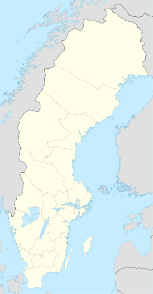
Deutsch: Positionskarte von Schweden
Quadratische Plattkarte, N-S-Streckung 214,7895 %. Geographische Begrenzung der Karte:
English: Location map of Sweden
Equirectangular projection, N/S stretching 214,7895 %. Geographic limits of the map:
|
||
| Date | |||
| Soorce | own work, using United States National Imagery and Mapping Agency data | ||
| Author | NordNordWest | ||
| Other versions |
Derivative works of this file:
|
||
| SVG genesis |
|


Licensin
I, the copyright holder of this work, hereby publish it under the following licenses:

|
Permission is grantit tae copy, distribute an/or modify this document unner the terms o the GNU Free Documentation License, Version 1.2 or ony later version published bi the Free Software Foundation; wi no Invariant Sections, no Front-Cover Texts, an no Back-Cover Texts. A copy o the license is includit in the section enteetled GNU Free Documentation License. |
This file is licensed unner the Creative Commons Attribution-Share Alike 3.0 Unported license.
- Ye are free:
- tae share – tae copy, distribute an transmit the wirk
- tae remix – tae adapt the wirk
- Unner the follaein condeetions:
- attribution – Ye must attribute the wirk in the manner specified bi the author or licensor (but nae in ony way that suggests that thay endorse ye or yer uise o the wirk).
- share alik – If ye alter, transform, or big upon this wirk, ye mey distribute the resultin wirk anly unner the same or seemilar license tae this ane.
Ye mey select the license o yer choice.
File history
Clap oan ae date/time fer tae see the file aes it kithed at that time.
| Date/Time | Thummnail | Dimensions | Uiser | Comment | |
|---|---|---|---|---|---|
| current | 23:26, 20 Mairch 2023 | | 954 × 1,836 (2.03 MB) | HCa | Reverted to version as of 18:28, 15 July 2008 (UTC) |
| 06:45, 1 November 2015 |  | 842 × 1,837 (1.01 MB) | Larske | Correction of border between Västra Götalands län and Jönköpings län. Habo municipality and Mullsjö municipality belong to Jönköpings län. | |
| 17:11, 4 August 2011 |  | 842 × 1,837 (981 KB) | NordNordWest | upd | |
| 09:24, 27 Januar 2009 |  | 954 × 1,837 (2.74 MB) | Erik Frohne | Added missing border Scania-Blekinge Category:Location maps of Sweden | |
| 08:22, 29 August 2008 |  | 954 × 1,837 (2.74 MB) | NordNordWest | ||
| 08:18, 29 August 2008 |  | 954 × 1,837 (1.46 MB) | NordNordWest | ||
| 11:32, 30 Julie 2008 |  | 954 × 1,836 (1.46 MB) | NordNordWest | optimized | |
| 18:28, 15 Julie 2008 |  | 954 × 1,836 (2.03 MB) | NordNordWest | {{Information |Description= {{de|Positionskarte von Schweden}} Quadratische Plattkarte, N-S-Streckung 190 %. Geographische Begrenzung der Karte: * N: 69.5° N * S: 55.1° N * W: 10.4° O * O: 24.6° O {{en|Location map of [[:en:Sweden|Swe |
Eimage airtins
Mair nor 100 pages airt til this file. The follaein leet shaws the first 100 page airtins that uise this file anely . Ae fu leet is available.
- Andalen
- Angered (locality)
- Aröd och Timmervik
- Asperö
- Benareby
- Berghem, Swaden
- Billdal
- Björketorp
- Björlanda
- Bleket
- Bohus-Björkö
- Bruzaholm
- Brännö
- Dannike
- Donsö
- Ed, Swaden
- Eskilsby och Snugga
- Fagerås
- Fristad
- Fritsla
- Gothenburg urban aurie
- Grästorp
- Gundal och Högås
- Hallerna
- Helsingborg
- Hemavan
- Henån
- Hindås
- Hjuvik
- Horred
- Hällesåker
- Hällingsjö
- Härryda
- Högboda
- Höviksnäs
- Igelstorp
- Jonsered
- Jörlanda
- Karlstad
- Kil, Värmland
- Klädesholmen
- Kvisljungeby
- Kåhög
- Kållekärr
- Kållered
- Landvetter
- Lindome
- Linköping
- Låssby
- Malmö
- Myggenäs
- Mysterna
- Mölnlycke
- Nolvik
- Norrköping
- Nya Långenäs
- Olofstorp
- Rosersberg
- Rya, Swaden
- Rävlanda
- Rödbo
- Rönnäng
- Sigtuna
- Sjuntorp
- Skultorp
- Skärhamn
- Starrkärr och Näs
- Stenared
- Stensele
- Stenungsund
- Stenungsön
- Stockholm
- Stora Bugärde
- Stora Dyrön
- Stora Höga
- Storuman
- Strandnorum
- Styrsö
- Stöpen
- Svanskog
- Svenshögen
- Säffle
- Säve
- Tahult
- Tidan
- Trollhättan
- Trulsegården
- Tulebo
- Tumlehed
- Tärnaby
- Tånga och Rögle
- Ucklum
- Utvälinge
- Vallåkra
- Vara, Swaden
- Vrångö
- Värmlandsbro
- Åstol
- Öckerö
- Ödsmål
See mair links til this file.
Global file uisage
The follaein ither wikis uise this file:
- Uisage on af.wikipedia.org
- Uisage on als.wikipedia.org
- Uisage on am.wikipedia.org
- Uisage on an.wikipedia.org
- Uisage on ar.wikipedia.org
- Uisage on arz.wikipedia.org
- Uisage on ast.wikipedia.org
View mair global usage o this file.