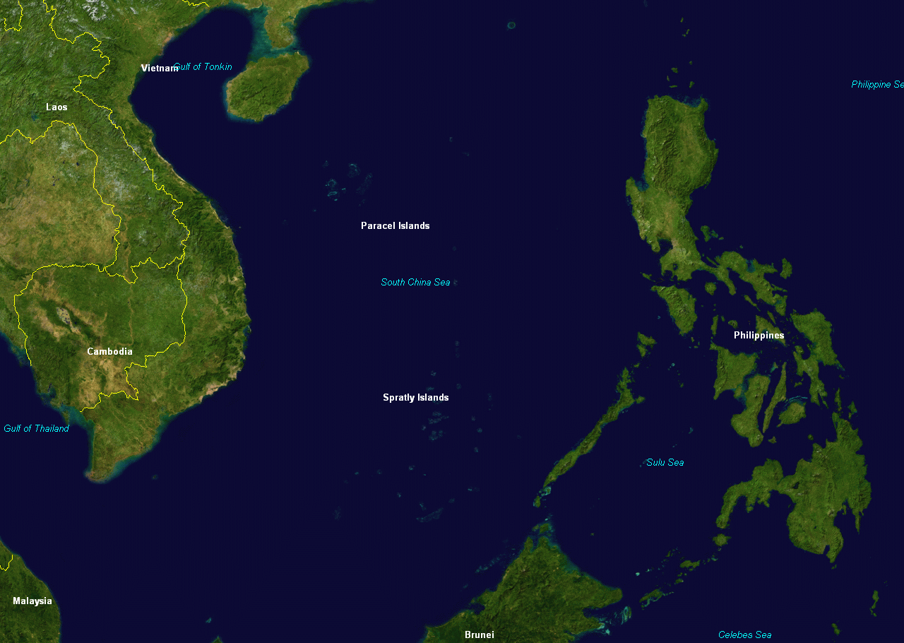
File:Spratly & Paracel Islands.png
Size o this luikower: 800 × 569 pixels. Ither resolutions: 320 × 228 pixels | 640 × 455 pixels | 1,024 × 728 pixels | 1,280 × 910 pixels.
Oreeginal file (1,280 × 910 pixels, file size: 254 KB, MIME type: image/png)
Ootline
| Descreeption | |
| Soorce | NASA |
| Author | NASA |
Licensin
| This image is in the public domain because it is a screenshot from NASA’s globe software World Wind using a public domain layer, such as Blue Marble, MODIS, Landsat, SRTM, USGS or GLOBE.
|
 |
Original upload log
The original description page was here. All following user names refer to en.wikipedia.
- 2005-03-08 05:34 DHN 1280×910×8 (313118 bytes) Spratly and Paracel Islands, from World Wind
- 2005-03-08 05:31 DHN 1280×910×8 (313118 bytes) Spratly and Paracel Islands, from World Wind
Original upload log
| Date/Time | Dimensions | Uiser | Comment |
|---|---|---|---|
| 18 Febuair 2008, 23:04:40 | 1280 × 910 (313118 bytes) | File Upload Bot (Magnus Manske) (tauk · contreebs) | {{BotMoveToCommons|en.wikipedia}} {{Information |Description={{en|Spratly and Paracel Islands, from [[:en:NASA World Wind]] [[:en:Category:Maps of the Paracel Islands]] [[:en:Category:Maps of the Spratly Islands]]}} |Source=Transferred from [http://en.w |
File history
Clap oan ae date/time fer tae see the file aes it kithed at that time.
| Date/Time | Thummnail | Dimensions | Uiser | Comment | |
|---|---|---|---|---|---|
| current | 17:35, 18 August 2015 | | 1,280 × 910 (254 KB) | GifTagger | Bot: Converting file to superior PNG file. (Source: Spratly & Paracel Islands.gif). This GIF was problematic due to non-greyscale color table. |
Eimage airtins
The follaein pages airts tae this image:
Global file uisage
The follaein ither wikis uise this file:
- Uisage on da.wikipedia.org
- Uisage on fr.wiktionary.org
- Uisage on ja.wikipedia.org
- Uisage on ms.wikipedia.org
- Uisage on pam.wikipedia.org
- Uisage on simple.wikipedia.org