File:Serbia and Montenegro.svg

Size of this PNG preview of this SVG file: 450 × 456 pixels. Ither resolutions: 237 × 240 pixels | 474 × 480 pixels | 758 × 768 pixels | 1,011 × 1,024 pixels | 2,021 × 2,048 pixels.
Oreeginal file (SVG file, nominallie 450 × 456 pixels, file size: 586 KB)
| Descreeption |
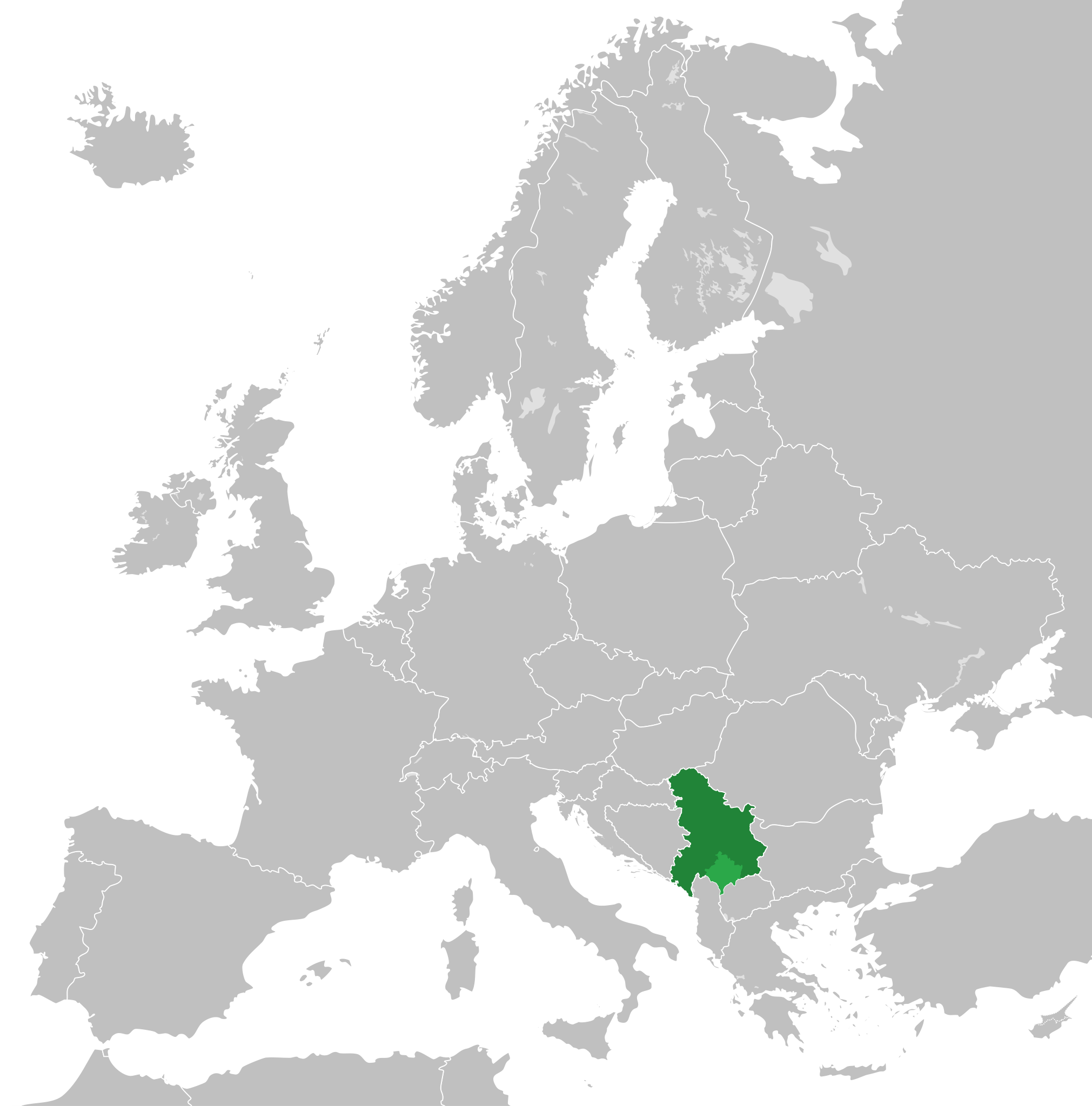
English: Map of the Federal Republic of Yugoslavia (1992-2003) and the State Union of Serbia and Montenegro (2003-2006).
Note: Following the adoption of Resolution 1244 on 10 June 1999, Kosovo was placed under a UN Interim Administration – de facto separating it from the rest of Yugoslavia. |
| Date | |
| Soorce | Own work, based upon File:Blank map of Europe.svg |
| Author |
This W3C-unspecified vector image was created with Inkscape . |
| Permission (Reuisin this file) |
This file is licensed unner the Creative Commons Attribution-Share Alike 3.0 Unported license.
|
File history
Clap oan ae date/time fer tae see the file aes it kithed at that time.
| Date/Time | Thummnail | Dimensions | Uiser | Comment | |
|---|---|---|---|---|---|
| current | 01:48, 31 August 2020 | | 450 × 456 (586 KB) | Savasampion | Kosovo fixed |
| 18:31, 27 Apryle 2019 |  | 450 × 456 (586 KB) | Illegitimate Barrister | cleanup nodes | |
| 05:05, 5 Julie 2018 |  | 450 × 456 (587 KB) | TRAJAN 117 | +++ | |
| 22:08, 2 Mey 2015 |  | 450 × 456 (584 KB) | TRAJAN 117 | +++ | |
| 13:15, 17 August 2013 |  | 680 × 520 (598 KB) | TRAJAN 117 | Adjustment | |
| 22:43, 13 December 2011 |  | 680 × 520 (654 KB) | TRAJAN 117 | {{Information |Description ={{en|1=Map of Serbia and Montenegro, circa 2002.}} |Source =Own work, based upon [http://commons.wikimedia.org/wiki/File:Blank_map_of_Europe.svg] |Author =25px '''[[ |
Eimage airtins
The follaein pages airts tae this image:
Global file uisage
The follaein ither wikis uise this file:
- Uisage on af.wikipedia.org
- Uisage on ar.wikipedia.org
- Uisage on arz.wikipedia.org
- Uisage on ast.wikipedia.org
- Uisage on azb.wikipedia.org
- Uisage on az.wikipedia.org
- Uisage on be-tarask.wikipedia.org
- Uisage on bg.wikipedia.org
- Uisage on bn.wikipedia.org
- Uisage on ca.wikipedia.org
- Uisage on cs.wikipedia.org
- Uisage on de.wikipedia.org
- Uisage on en.wikipedia.org
- Uisage on en.wikinews.org
- Uisage on eo.wikipedia.org
- Uisage on es.wikipedia.org
- Uisage on fa.wikipedia.org
- Uisage on fi.wikipedia.org
- Uisage on fr.wikipedia.org
- Uisage on fr.wikinews.org
- Uisage on ga.wikipedia.org
- Uisage on gl.wikipedia.org
- Uisage on he.wikipedia.org
- Uisage on hr.wikipedia.org
- Uisage on hy.wikipedia.org
- Uisage on ia.wikipedia.org
- Uisage on id.wikipedia.org
- Uisage on incubator.wikimedia.org
- Uisage on it.wikipedia.org
- Uisage on ja.wikipedia.org
- Uisage on kk.wikipedia.org
- Uisage on ko.wikipedia.org
- Uisage on lb.wikipedia.org
- Uisage on li.wikipedia.org
View mair global usage o this file.