File:Rupsha bridge.jpg

Size o this luikower: 800 × 499 pixels. Ither resolutions: 320 × 200 pixels | 640 × 399 pixels | 1,024 × 639 pixels | 1,280 × 798 pixels | 3,000 × 1,871 pixels.
Oreeginal file (3,000 × 1,871 pixels, file size: 2.58 MB, MIME type: image/jpeg)
Ootline
| Descreeption |
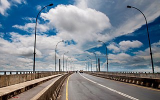
English: Rupsha Bridge, Khulna, Bangladesh. বাংলা: রূপসা সেতু |
| Date | |
| Soorce | Ain wirk |
| Author | Balaram Mahalder |
| Other versions |
| Camera location | | View this and other nearby images on: OpenStreetMap |
|---|
Licensin
I, the copyright holder of this work, hereby publish it under the following license:
This file is licensed under the Creative Commons Attribution-Share Alike 4.0 International license.
- Ye are free:
- tae share – tae copy, distribute an transmit the wirk
- tae remix – tae adapt the wirk
- Unner the follaein condeetions:
- attribution – Ye must attribute the wirk in the manner specified bi the author or licensor (but nae in ony way that suggests that thay endorse ye or yer uise o the wirk).
- share alik – If ye alter, transform, or big upon this wirk, ye mey distribute the resultin wirk anly unner the same or seemilar license tae this ane.

|
This image has been assessed under the valued image criteria and is considered the most valued image on Commons within the scope: Rupsha Bridge (roadway). You can see its nomination here. |
This image was selected as picture of the day on Bengali Wikipedia.
|
File history
Clap oan ae date/time fer tae see the file aes it kithed at that time.
| Date/Time | Thummnail | Dimensions | Uiser | Comment | |
|---|---|---|---|---|---|
| current | 16:47, 2 August 2014 | | 3,000 × 1,871 (2.58 MB) | Balaram Mahalder | User created page with UploadWizard |
Eimage airtins
The'r nae pages airts tae this eimage.
Global file uisage
The follaein ither wikis uise this file:
- Uisage on bn.wikipedia.org
- Uisage on bn.wikivoyage.org
- Uisage on en.wikipedia.org
- Uisage on en.wikivoyage.org
- Uisage on he.wikipedia.org
- Uisage on hi.wikipedia.org
- Uisage on ka.wikipedia.org
- Uisage on ml.wikipedia.org
- Uisage on www.wikidata.org