File:Relief Map of Norway.png
Size o this luikower: 564 × 599 pixels. Ither resolutions: 226 × 240 pixels | 452 × 480 pixels | 723 × 768 pixels | 1,200 × 1,275 pixels.
Oreeginal file (1,200 × 1,275 pixels, file size: 2.13 MB, MIME type: image/png)
Ootline
| Descreeption |
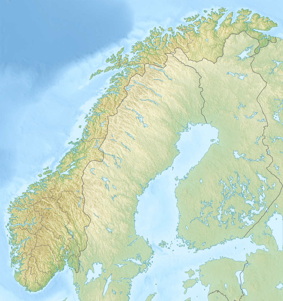
English: Relief map of Norway
Equirectangular projection, N/S stretching 210 %. Geographic limits of the map:
|
| Date | |
| Soorce |
|
| Author | derivative work Виктор_В |

|
File:Norway rel location map.svg is a vector version o this file. It should be uised in place o this raster image when nae inferior.
File:Relief Map of Norway.png → File:Norway rel location map.svg
For mair information, see Help:SVG. |
 |
Licensin
I, the copyright holder of this work, hereby publish it under the following licenses:

|
Permission is grantit tae copy, distribute an/or modify this document unner the terms o the GNU Free Documentation License, Version 1.2 or ony later version published bi the Free Software Foundation; wi no Invariant Sections, no Front-Cover Texts, an no Back-Cover Texts. A copy o the license is includit in the section enteetled GNU Free Documentation License. |
This file is licensed unner the Creative Commons Attribution-Share Alike 3.0 Unported license.
- Ye are free:
- tae share – tae copy, distribute an transmit the wirk
- tae remix – tae adapt the wirk
- Unner the follaein condeetions:
- attribution – Ye must attribute the wirk in the manner specified bi the author or licensor (but nae in ony way that suggests that thay endorse ye or yer uise o the wirk).
- share alik – If ye alter, transform, or big upon this wirk, ye mey distribute the resultin wirk anly unner the same or seemilar license tae this ane.
Ye mey select the license o yer choice.
File history
Clap oan ae date/time fer tae see the file aes it kithed at that time.
| Date/Time | Thummnail | Dimensions | Uiser | Comment | |
|---|---|---|---|---|---|
| current | 22:16, 30 December 2017 | | 1,200 × 1,275 (2.13 MB) | NordNordWest | upd 2018 |
| 18:01, 10 December 2010 |  | 1,200 × 1,275 (2.18 MB) | Виктор В | м | |
| 17:42, 28 August 2010 |  | 1,200 × 1,275 (2.4 MB) | Виктор В | Рельеф дна | |
| 16:42, 28 August 2010 |  | 1,200 × 1,275 (1.93 MB) | Виктор В | мелкие исправления | |
| 12:13, 28 August 2010 |  | 1,200 × 1,275 (2.01 MB) | Виктор В | == {{int:filedesc}} == {{Information |Description={{en|Relief map of Norway}} Equirectangular projection, N/S stretching 210 %. Geographic limits of the map: * N: 71.5° N * S: 57.6° N * W: 4.1° E * E: 31.6° E |Source=*[[:File:Norway loc |
Eimage airtins
The follaein pages airts tae this image:
Global file uisage
The follaein ither wikis uise this file:
- Uisage on als.wikipedia.org
- Uisage on ar.wikipedia.org
- Uisage on arz.wikipedia.org
- Uisage on ast.wikipedia.org
- Uisage on azb.wikipedia.org
- Uisage on ba.wikipedia.org
- Uisage on be.wikipedia.org
- Шаблон:На карце/Нарвегія
- Руген (возера)
- Бюгдзін
- Фемун
- М’ёса
- Росватн
- Глома
- Бёўра
- Гёўла
- Отра
- Паз
- Ранэльва
- Танаэльва
- Нідэльва
- Вефсна
- Банак
- Брэймсватн
- Клістэрватн
- Кродэрэн
- Ломіватн
- Мёсватн
- Тутак
- Сперылен
- Хелін
- Недрэватн
- Бюглансфіёрд
- Цюрыфіёрд
- Хорніндальсватнет
- Рансфіёрдэн
- Скугсфіёрдватнет
- Осла-фіёрд
- Лафатэнскія астравы
- Вёрынгсфосен
- Вестфіёрд
- Гальхёпіген
- Глітэртын
- Нордкін
- Ютунхеймен
- Нацыянальны парк Юнкердаль
- Оркла
- Юстэдальбрэен
- Офат-фіёрд
- Геаграфія Нарвегіі
View mair global usage o this file.