File:Relief Map of Kazakhstan.png

Size o this luikower: 800 × 457 pixels. Ither resolutions: 320 × 183 pixels | 640 × 366 pixels | 1,200 × 686 pixels.
Oreeginal file (1,200 × 686 pixels, file size: 1.24 MB, MIME type: image/png)
Ootline
| Descreeption |
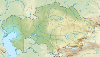
English: Location map of Kazakhstan
Equirectangular projection, N/S stretching 150 %. Geographic limits of the map:
|
| Date | |
| Soorce |
|
| Author |
|
| Permission (Reuisin this file) |
This file is licensed unner the Creative Commons Attribution-Share Alike 3.0 Unported license.
|
File history
Clap oan ae date/time fer tae see the file aes it kithed at that time.
| Date/Time | Thummnail | Dimensions | Uiser | Comment | |
|---|---|---|---|---|---|
| current | 17:10, 9 October 2022 | | 1,200 × 686 (1.24 MB) | NordNordWest | upd 2022 |
| 19:41, 26 August 2010 |  | 1,200 × 686 (1.39 MB) | Виктор В | =={{int:filedesc}}== {{Information |Description={{en|Location map of Kazakhstan}} Equirectangular projection, N/S stretching 150 %. Geographic limits of the map: * N: 56° N * S: 40° N * W: 46° E * E: 88° E |Source=*[[:File:Kazakhsta |
Eimage airtins
The follaein pages airts tae this image:
Global file uisage
The follaein ither wikis uise this file:
- Uisage on ar.wikipedia.org
- Uisage on ast.wikipedia.org
- Uisage on av.wikipedia.org
- Uisage on azb.wikipedia.org
- Uisage on az.wikipedia.org
- Balxaş
- Şablon:Yer xəritəsi Qazaxıstan
- Alagöl (Qazaxıstan)
- Mangistau yarımadası
- Aral gölü
- Vernı zəlzələsi (1887)
- Bozaşı yarımadası
- Spirkin Oseredok
- Janbay
- Durnev
- Tülen adaları
- Kulalı
- Manqışlaq körfəzi
- Böyük Peşnıye adaları
- Qazax körfəzi
- Kaydak körfəzi
- Myortvıy Kultuk körfəzi
- Qızılqum
- Üstyurd
- Mirzəçöl
- Aral Qaraqumu
- Çaqan gölü
- Bayanaul Milli Parkı
- İle-Alatau Milli Parkı
- Altın-Emel Milli Parkı
- Betpak-Dala
- Narın qumlar (səhra)
- Tauqum
- Jalqum
- Lyuqqum
- Barbıqum
- Böyük və Kiçik Porsuq
- Ayğırqum
- Sarıesik-Atırau
- Bestasqum
- Uzun-Aral
- Muyunqum
- Jamanqum
- Aralqum
- Barmaqqum
- Batpaysaqır
- Qaraqum (Almatı dairəsinin şimalında səhra)
- Qaraqum (Almatı dairəsinin cənubunda səhra)
- Muyunqum (Alma-ata dairsində səhra)
View mair global usage o this file.