File:Philippines location map.svg

Size of this PNG preview of this SVG file: 454 × 599 pixels. Ither resolutions: 182 × 240 pixels | 364 × 480 pixels | 582 × 768 pixels | 776 × 1,024 pixels | 1,552 × 2,048 pixels | 1,871 × 2,468 pixels.
Oreeginal file (SVG file, nominallie 1,871 × 2,468 pixels, file size: 2.18 MB)
Ootline
| Descreeption |
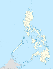
Deutsch: Positionskarte der Philippinen
Quadratische Plattkarte, N-S-Streckung 103 %. Geographische Begrenzung der Karte:
English: Location map of the Philippines
Equirectangular projection, N/S stretching 103 %. Geographic limits of the map:
|
| Date | |
| Soorce |
own work, using
|
| Author | NordNordWest |
| Other versions |
|


|
This map has been made or improved in the German Kartenwerkstatt (Map Lab). You can propose maps to improve as well.
|
Licensin
I, the copyright holder of this work, hereby publish it under the following licenses:

|
Permission is grantit tae copy, distribute an/or modify this document unner the terms o the GNU Free Documentation License, Version 1.2 or ony later version published bi the Free Software Foundation; wi no Invariant Sections, no Front-Cover Texts, an no Back-Cover Texts. A copy o the license is includit in the section enteetled GNU Free Documentation License. |
This file is licensed under the Creative Commons Attribution 3.0 Unported license.
- Ye are free:
- tae share – tae copy, distribute an transmit the wirk
- tae remix – tae adapt the wirk
- Unner the follaein condeetions:
- attribution – Ye must attribute the wirk in the manner specified bi the author or licensor (but nae in ony way that suggests that thay endorse ye or yer uise o the wirk).
Ye mey select the license o yer choice.
File history
Clap oan ae date/time fer tae see the file aes it kithed at that time.
| Date/Time | Thummnail | Dimensions | Uiser | Comment | |
|---|---|---|---|---|---|
| current | 22:17, 25 Mairch 2016 | | 1,871 × 2,468 (2.18 MB) | Man77 | upd NIR, Davao |
| 11:46, 14 October 2013 |  | 1,871 × 2,468 (2.2 MB) | Hariboneagle927 | fix | |
| 11:07, 14 October 2013 |  | 1,871 × 2,468 (2.15 MB) | Hariboneagle927 | fix. Cagayan | |
| 10:58, 14 October 2013 |  | 1,871 × 2,468 (2.15 MB) | Hariboneagle927 | Made some update and corrected some minor errors. | |
| 07:22, 9 October 2013 |  | 1,871 × 2,468 (2.14 MB) | Hellerick | Regrouped for easier recoloring. | |
| 06:13, 7 August 2013 |  | 1,871 × 2,468 (1.07 MB) | Hellerick | Regional division replaced with provincial division. | |
| 19:09, 5 Julie 2009 |  | 1,871 × 2,468 (1,009 KB) | NordNordWest | ||
| 21:04, 25 Mey 2009 |  | 1,687 × 2,469 (999 KB) | NordNordWest | {{Information |Description= {{de|Positionskarte der Philippinen}} Quadratische Plattkarte, N-S-Streckung 103 %. Geographische Begrenzung der Karte: * N: 21.2° N * S: 4.3° N * W: 115.4° O * O: 127.3° O {{en|Location map of the [[:en |
Eimage airtins
The follaein pages airts tae this image:
Global file uisage
The follaein ither wikis uise this file:
- Uisage on af.wikipedia.org
- Uisage on als.wikipedia.org
- Uisage on an.wikipedia.org
- Uisage on az.wikipedia.org
- Uisage on be-tarask.wikipedia.org
- Uisage on be.wikipedia.org
- Uisage on bn.wikipedia.org
- Uisage on ce.wikipedia.org
- Uisage on ckb.wikipedia.org
- Uisage on crh.wikipedia.org
- Uisage on cs.wikipedia.org
View mair global usage o this file.