File:Outline Map of Kostroma Oblast.svg

Size of this PNG preview of this SVG file: 800 × 560 pixels. Ither resolutions: 320 × 224 pixels | 640 × 448 pixels | 1,024 × 716 pixels | 1,280 × 895 pixels | 2,560 × 1,791 pixels | 4,476 × 3,131 pixels.
Oreeginal file (SVG file, nominallie 4,476 × 3,131 pixels, file size: 98 KB)
Ootline
| Descreeption |
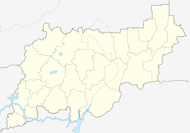
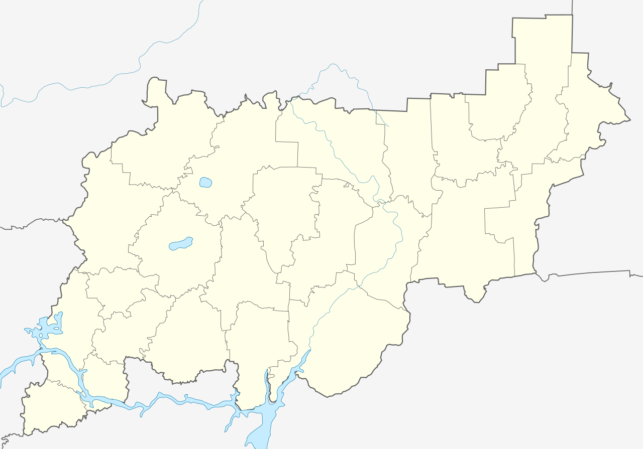
Русский: Контурная карта Костромской области, с границами районов и водоёмами.
|
| Date | |
| Soorce |
This W3C-unspecified vector image was created with Inkscape . |
| Author | Nzeemin |
| Other versions |
|

Licensin
I, the copyright holder of this work, hereby publish it under the following license:
This file is licensed unner the Creative Commons Attribution-Share Alike 3.0 Unported license.
- Ye are free:
- tae share – tae copy, distribute an transmit the wirk
- tae remix – tae adapt the wirk
- Unner the follaein condeetions:
- attribution – Ye must attribute the wirk in the manner specified bi the author or licensor (but nae in ony way that suggests that thay endorse ye or yer uise o the wirk).
- share alik – If ye alter, transform, or big upon this wirk, ye mey distribute the resultin wirk anly unner the same or seemilar license tae this ane.
File history
Clap oan ae date/time fer tae see the file aes it kithed at that time.
| Date/Time | Thummnail | Dimensions | Uiser | Comment | |
|---|---|---|---|---|---|
| current | 21:05, 30 Mairch 2012 | | 4,476 × 3,131 (98 KB) | Nzeemin | border and rivers |
| 11:22, 7 Februar 2012 |  | 4,476 × 3,131 (84 KB) | Nzeemin | opacity fixed | |
| 11:20, 7 Februar 2012 |  | 4,476 × 3,131 (84 KB) | Nzeemin |
Eimage airtins
The follaein pages airts tae this image:
Global file uisage
The follaein ither wikis uise this file:
- Uisage on af.wikipedia.org
- Uisage on azb.wikipedia.org
- Uisage on ba.wikipedia.org
- Uisage on be.wikipedia.org
- Буй (горад)
- Нерахта
- Шаблон:На карце/Расія Кастрамская вобласць
- Судзіслаўль
- Сусаніна (Кастрамская вобласць)
- Краснае-на-Волзе
- Парфеньева (Парфеньеўскі раён)
- Кадый
- Гарчуха
- Паўднявіца (пасёлак)
- Паназырава
- Павіна (сяло, Кастрамская вобласць)
- Пышчуг
- Вохма (пасёлак)
- Чыстыя Бары
- Вятлужскі (Кастрамская вобласць)
- Антропава (Антропаўскі раён)
- Астроўскае (Кастрамская вобласць)
- Uisage on bg.wikipedia.org
- Uisage on ce.wikipedia.org
- Кострома
- Батуриха (Октябрьскан кӀошт)
- Федюнино (Костромин область)
- Талица (Барановон йуьртан меттиг)
- Круглица (Шарьян кӀошт)
- Афонински (Октябрьскан кӀошт)
- Барабаново (Шарьян кӀошт)
- Алексино (Антропован кӀошт)
- Антропово (Антропован кӀошт)
- Белозёрово (Антропован кӀошт)
- Бетелёво
- Бобново
- Болотово (Антропован кӀошт)
- Ботвино (Антропован кӀошт)
- Бурдаково
- Бушнево (Костромин область)
- Быково (Антропован кӀошт)
- Васютки
- Власьевка (Антропован кӀошт)
- Волково (Антропован кӀошт)
- Вольгино
- Воскресенски (Антропован кӀошт)
View mair global usage o this file.