File:Map of the Faroe Islands en.svg

Size of this PNG preview of this SVG file: 457 × 600 pixels. Ither resolutions: 183 × 240 pixels | 366 × 480 pixels | 585 × 768 pixels | 780 × 1,024 pixels | 1,561 × 2,048 pixels | 1,683 × 2,208 pixels.
Oreeginal file (SVG file, nominallie 1,683 × 2,208 pixels, file size: 763 KB)
Ootline
| Descreeption |
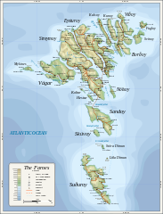
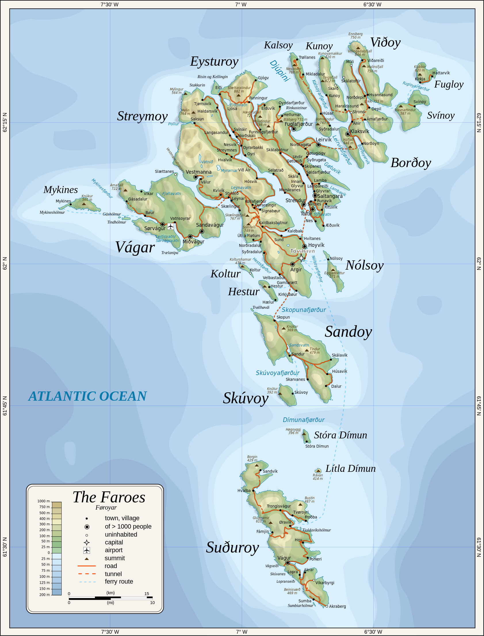
English: Topographic map of the Faroe Islands.
Suomi: Färsaarten topografinen kartta.
Coastline, roads, place names, and summits based partly on File:Faroe map with villages, streets, straits, firths, ferry harbours and major moutains.png. Topography based on public domain GLOBE data from NOAA (http://www.ngdc.noaa.gov/mgg/topo/gltiles.html). Relief shading is an embedded PNG raster, derived from ETOPO2 data. Bathymetry from NGDC ETOPO2 (low resolution raster with a "blur" property). |
| Date | 2009-01-28, 2024-02-11 |
| Soorce | Ain wirk |
| Author | Oona Räisänen |
| Other versions |
Derivative works of this file: |
| SVG genesis |
Licensin
Oona Räisänen (Mysid), the copyright holder of this work, hereby publishes it under the following licenses:
This file is licensed unner the Creative Commons Attribution-Share Alike 3.0 Unported license.
Attribution: Oona Räisänen (Mysid)
- Ye are free:
- tae share – tae copy, distribute an transmit the wirk
- tae remix – tae adapt the wirk
- Unner the follaein condeetions:
- attribution – Ye must attribute the wirk in the manner specified bi the author or licensor (but nae in ony way that suggests that thay endorse ye or yer uise o the wirk).
- share alik – If ye alter, transform, or big upon this wirk, ye mey distribute the resultin wirk anly unner the same or seemilar license tae this ane.

|
Permission is grantit tae copy, distribute an/or modify this document unner the terms o the GNU Free Documentation License, Version 1.2 or ony later version published bi the Free Software Foundation; wi no Invariant Sections, no Front-Cover Texts, an no Back-Cover Texts. A copy o the license is includit in the section enteetled GNU Free Documentation License. |
Ye mey select the license o yer choice.
File history
Clap oan ae date/time fer tae see the file aes it kithed at that time.
| Date/Time | Thummnail | Dimensions | Uiser | Comment | |
|---|---|---|---|---|---|
| current | 20:53, 11 Februar 2024 | | 1,683 × 2,208 (763 KB) | Mysid | 'Multiply' blend mode didn't work - trying with alpha channel. |
| 20:34, 11 Februar 2024 |  | 1,683 × 2,208 (733 KB) | Mysid | Added new 2023 tunnel, new names of some villages, fixed mistakes and svg errors, details | |
| 09:18, 19 Julie 2010 |  | 1,683 × 2,208 (539 KB) | Mysid | oops, legend missing | |
| 09:16, 19 Julie 2010 |  | 1,683 × 2,208 (539 KB) | Mysid | better choices for fonts | |
| 19:22, 28 Januar 2009 |  | 1,683 × 2,208 (694 KB) | Mysid | remove ext. images | |
| 19:21, 28 Januar 2009 |  | 1,683 × 2,208 (694 KB) | Mysid | embed all rasters | |
| 18:52, 28 Januar 2009 |  | 1,683 × 2,208 (653 KB) | Mysid | {{Information |Description={{en|1=Topographic map of the Faroe Islands.}} |Source=Own work by uploader |Author=Mysid |Date=2009-01-28 |Permission= |other_versions= }} <!--{{ImageUpload|full}}--> Category:Maps of the Faroe Islands |
Eimage airtins
The follaein pages airts tae this image:
Global file uisage
The follaein ither wikis uise this file:
- Uisage on bg.wikipedia.org
- Uisage on bn.wikipedia.org
- Uisage on dsb.wikipedia.org
- Uisage on el.wikipedia.org
- Uisage on en.wikipedia.org
- Uisage on es.wikipedia.org
- Uisage on fa.wikipedia.org
- Uisage on fi.wikipedia.org
- Uisage on fo.wikipedia.org
- Uisage on frr.wikipedia.org
- Uisage on fr.wikipedia.org
- Uisage on ga.wikipedia.org
- Uisage on hu.wikipedia.org
- Uisage on ia.wikipedia.org
- Uisage on is.wikipedia.org
- Uisage on it.wikipedia.org
- Uisage on ka.wikipedia.org
- Uisage on kk.wikipedia.org
- Uisage on ko.wikipedia.org
- Uisage on lb.wikipedia.org
- Uisage on lez.wikipedia.org
- Uisage on mi.wikipedia.org
- Uisage on mk.wikipedia.org
- Uisage on nl.wikipedia.org
- Uisage on ru.wikipedia.org
- Uisage on scn.wikipedia.org
- Uisage on sc.wikipedia.org
- Uisage on sr.wikipedia.org
- Uisage on sv.wikipedia.org
View mair global usage o this file.