File:Location map of the Irish Free State.svg

Size of this PNG preview of this SVG file: 442 × 442 pixels. Ither resolutions: 240 × 240 pixels | 480 × 480 pixels | 768 × 768 pixels | 1,024 × 1,024 pixels | 2,048 × 2,048 pixels.
Oreeginal file (SVG file, nominallie 442 × 442 pixels, file size: 1.39 MB)
Ootline
| Descreeption |
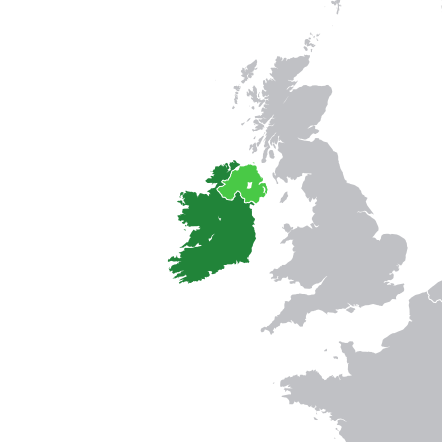
English: Location map of the Irish Free State. |
| Date | |
| Soorce |
Derived from: |
| Author | Rob984 |
_cropped.svg)
Licensin
I, the copyright holder of this work, hereby publish it under the following license:
This file is licensed under the Creative Commons Attribution-Share Alike 4.0 International license.
- Ye are free:
- tae share – tae copy, distribute an transmit the wirk
- tae remix – tae adapt the wirk
- Unner the follaein condeetions:
- attribution – Ye must attribute the wirk in the manner specified bi the author or licensor (but nae in ony way that suggests that thay endorse ye or yer uise o the wirk).
- share alik – If ye alter, transform, or big upon this wirk, ye mey distribute the resultin wirk anly unner the same or seemilar license tae this ane.
File history
Clap oan ae date/time fer tae see the file aes it kithed at that time.
| Date/Time | Thummnail | Dimensions | Uiser | Comment | |
|---|---|---|---|---|---|
| current | 14:54, 21 Juin 2015 | | 442 × 442 (1.39 MB) | Rob984 | France–Belgium border |
| 15:07, 10 November 2014 |  | 442 × 442 (1.39 MB) | Rob984 | User created page with UploadWizard |
Eimage airtins
The follaein pages airts tae this image:
Global file uisage
The follaein ither wikis uise this file:
- Uisage on ar.wikipedia.org
- Uisage on bg.wikipedia.org
- Uisage on cs.wikipedia.org
- Uisage on en.wikiquote.org
- Uisage on es.wikipedia.org
- Uisage on fa.wikipedia.org
- Uisage on fi.wikipedia.org
- Uisage on he.wikipedia.org
- Uisage on hi.wikipedia.org
- Uisage on id.wikipedia.org
- Uisage on io.wikipedia.org
- Uisage on is.wikipedia.org
- Uisage on it.wikipedia.org
- Uisage on lv.wikipedia.org
- Uisage on mk.wikipedia.org
- Uisage on pl.wikipedia.org
- Uisage on pt.wikipedia.org
- Uisage on ru.wikipedia.org
- Uisage on sh.wikipedia.org
- Uisage on th.wikipedia.org
- Uisage on vi.wikipedia.org
- Uisage on zh.wikipedia.org