File:Location map Netherlands Greater Amsterdam.png

Size o this luikower: 626 × 600 pixels. Ither resolutions: 250 × 240 pixels | 501 × 480 pixels | 769 × 737 pixels.
Oreeginal file (769 × 737 pixels, file size: 667 KB, MIME type: image/png)
| Descreeption |
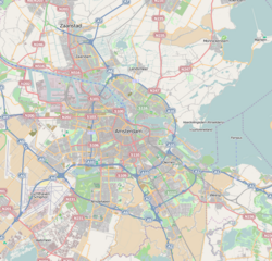
English: Map of Amsterdam
Geographic limits of the map:
This file is licensed under the Creative Commons Attribution-Share Alike 2.0 Generic license.
|
| Soorce | OpenStreetMap |
| Author | Dr. Blofeld |
File history
Clap oan ae date/time fer tae see the file aes it kithed at that time.
| Date/Time | Thummnail | Dimensions | Uiser | Comment | |
|---|---|---|---|---|---|
| current | 11:39, 14 Mey 2010 | | 769 × 737 (667 KB) | Dr. Blofeld~commonswiki | {{Information |Description={{en|1=l}} |Source=l |Author=l |Date=l |Permission= |other_versions= }} |
Eimage airtins
The follaein pages airts tae this image:
Global file uisage
The follaein ither wikis uise this file:
- Uisage on ar.wikipedia.org
- Uisage on bn.wikipedia.org
- Uisage on ceb.wikipedia.org
- Uisage on en.wikipedia.org
- Amsterdam Airport Schiphol
- 1928 Summer Olympics
- IJ (Amsterdam)
- Amsterdam Zuid station
- Football at the 1928 Summer Olympics
- Dijkgraafplein
- Hilton Amsterdam
- Zaans Museum
- Museum Jan
- Module:Location map/data/Netherlands Amsterdam Greater/doc
- Prinses Irenebuurt
- Tuindorp Oostzaan
- World of Ajax
- Amsterdam derby
- Museum tot zover
- Ito-toren
- Module:Location map/data/Netherlands Amsterdam Greater
- Rembrandtpark
- 2022–23 Vierde Divisie
- 2023–24 Vierde Divisie
- Uisage on eu.wikipedia.org
- Uisage on fa.wikipedia.org
- Uisage on fr.wikipedia.org
- Musée d'Amsterdam
- Stadionplein
- Munttoren
- Palais royal d'Amsterdam
- Noorderkerk
- Oude Kerk d'Amsterdam
- Basilique Saint-Nicolas d'Amsterdam
- Leidseplein
- Place du Dam
- Museumplein
- Nieuwe Kerk d'Amsterdam
- Zuiderkerk (Amsterdam)
- Modèle:Géolocalisation/Amsterdam
- Spui (Amsterdam)
- Rembrandtplein
- Arbre d'Anne Frank
- Amsterdam-Centre
- Prinsengracht
- Église Moïse-et-Aaron
- Oudezijds Kolk
View mair global usage o this file.