File:Kazakhstan (orthographic projection).svg

Size of this PNG preview of this SVG file: 553 × 553 pixels. Ither resolutions: 240 × 240 pixels | 480 × 480 pixels | 768 × 768 pixels | 1,024 × 1,024 pixels | 2,048 × 2,048 pixels.
Oreeginal file (SVG file, nominallie 553 × 553 pixels, file size: 309 KB)
ҚАЗАҚСТАН
Ootline
| Descreeption |
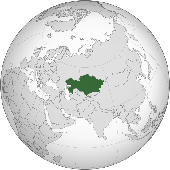
English: Kazakhstan |
||||
| Date | |||||
| Soorce |
S So2009
lberg J:
|
||||
| Author | Turkish Flame | ||||
| Other versions |
.svg) |
||||
| SVG genesis |
.svg)

.svg)
.svg)
.svg)
.svg)
.svg)
.svg)
.svg)
.svg)
.svg)
.svg)
.svg)
.svg)
.svg)
.svg)
.svg)
.svg)
.svg)
.svg)
.svg)
.svg)
.svg)
.svg)
.svg)
.svg)
.svg)
.svg)
.svg)
.svg)
.svg)
.svg)
.svg)
.svg)
.svg)
.svg)
.svg)
.svg)
.svg)
.svg)
.svg)
.svg)
.svg)
.svg)
.svg)
.svg)
.svg)
.svg)
.svg)
.svg)
.svg)
.svg)
.svg)
.svg)
.svg)
.svg)
.svg)
.svg)
.svg)
.svg)
.svg)
.svg)
.svg)
.svg)
.svg)
.svg)
.svg)
.svg)
.svg)
.svg)
.svg)
.svg)
.svg)
.svg)
.svg)

.svg)

.svg)

.svg)
.svg)
.svg)
.svg)
.svg)
.svg)
.svg)


.svg)
.svg)
.svg)
.svg)
.svg)
.svg)
.svg)

.svg)
.svg)
.svg)
.svg)
.svg)
.svg)
.svg)
.svg)
.svg)

.svg)
.svg)
.svg)
.svg)
.svg)
.svg)
.svg)
_without_national_boundaries.svg)
.svg)
.svg)
.svg)
.svg)
.svg)
.svg)

.svg)
.svg)
.png)
.svg)
.svg)
.svg)
.svg)

.svg)
.svg)
.svg)
.svg)
.svg)
.svg)
.svg)
.svg)
.svg)
.svg)
.svg)

.svg)
.svg)
.svg)
.svg)
.svg)
.svg)
.svg)
.svg)
.svg)

.svg)
.svg)

.svg)
.svg)
.svg)
.svg)
.svg)
.svg)
.svg)
.svg)
.svg)
.svg)
.svg)
.svg)
.svg)
.svg)
.svg)
.svg)
.svg)
.svg)
.svg)
.svg)
.svg)
.svg)
.svg)
.svg)
.svg)
.svg)
.svg)
_-_Crimea_disputed.svg)
.svg)
.svg)
.svg)
.svg)
.svg)
.svg)
.svg)
.svg)
.svg)
.svg)
.svg)
_political.svg)
.svg)
.svg)
.svg)
.svg)
_-_Crimea_disputed_-_no_borders.svg)
.svg)
.svg)
.svg)
.svg)
.svg)
.svg)
.svg)
.svg)
.svg)
.svg)
.svg)

.svg)
.svg)
.svg)

.png)
.svg)
.svg)
.svg)
.svg)
.svg)
.svg)
.svg)
.svg)
.svg)
.svg)
.svg)
.svg)
.svg)
.svg)
.svg)
.svg)
.svg)
.svg)
.svg)
.svg)
.svg)
.svg)
.svg)
.svg)
.svg)
.svg)
.svg)
.svg)
.svg)
.svg)
.svg)
.svg)
.svg)
.svg)
.png)
.svg)
.svg)
.svg)
_(orthographic_projection).png)
.svg)
Licensin
I, the copyright holder of this work, hereby publish it under the following license:
This file is licensed under the Creative Commons Attribution 3.0 Unported license.
- Ye are free:
- tae share – tae copy, distribute an transmit the wirk
- tae remix – tae adapt the wirk
- Unner the follaein condeetions:
- attribution – Ye must attribute the wirk in the manner specified bi the author or licensor (but nae in ony way that suggests that thay endorse ye or yer uise o the wirk).
File history
Clap oan ae date/time fer tae see the file aes it kithed at that time.
| Date/Time | Thummnail | Dimensions | Uiser | Comment | |
|---|---|---|---|---|---|
| current | 02:31, 5 December 2015 | | 553 × 553 (309 KB) | Chronus | Reverted to version as of 23:38, 16 March 2015 (UTC) |
| 03:05, 20 November 2015 |  | 553 × 553 (348 KB) | Salmunete | Kazakhstan (dark green) in the EEU (light green) | |
| 23:38, 16 Mairch 2015 |  | 553 × 553 (309 KB) | Flappiefh | Removed Somaliland and Kosovo. Separated Western Sahara and Morroco. | |
| 12:32, 4 August 2013 |  | 553 × 553 (313 KB) | Flappiefh | Added South Sudan. | |
| 17:10, 1 November 2008 |  | 541 × 541 (563 KB) | Turkish Flame~commonswiki | == Summary == {{Information |Description={{en|1=Kazakhstan}} |Source=Own work, {{Inkscape}}<br />[http://www.aquarius.geomar.de/omc/make_map.html Aquarius.geomar.de]<br />{{GFDL-GMT}} |Author=Turkish Flame |Date=1 November 2008 |Per |
Eimage airtins
The follaein pages airts tae this image:
Global file uisage
The follaein ither wikis uise this file:
- Uisage on ace.wikipedia.org
- Uisage on af.wikipedia.org
- Uisage on alt.wikipedia.org
- Uisage on ang.wikipedia.org
- Uisage on arc.wikipedia.org
- Uisage on ar.wikipedia.org
- كازاخستان
- بوابة:العالم الإسلامي/دولة مختارة/أرشيف
- بوابة:العالم الإسلامي/دولة مختارة/22
- قائمة الدول ذات السيادة والأقاليم التابعة في آسيا
- معاملة المثليين في كازاخستان
- مستخدم:جار الله/قائمة صور مقالات العلاقات الثنائية
- العلاقات الأمريكية الكازاخستانية
- العلاقات الأنغولية الكازاخستانية
- العلاقات الكازاخستانية الكورية الجنوبية
- العلاقات الإريترية الكازاخستانية
- العلاقات السويسرية الكازاخستانية
- العلاقات الألمانية الكازاخستانية
- العلاقات الكازاخستانية الليختنشتانية
- العلاقات البوليفية الكازاخستانية
- العلاقات الكازاخستانية الموزمبيقية
- العلاقات الألبانية الكازاخستانية
- العلاقات البلجيكية الكازاخستانية
- العلاقات الإثيوبية الكازاخستانية
- العلاقات البيلاروسية الكازاخستانية
- العلاقات الطاجيكستانية الكازاخستانية
- العلاقات الروسية الكازاخستانية
- العلاقات الرومانية الكازاخستانية
- العلاقات الأرجنتينية الكازاخستانية
- العلاقات الغامبية الكازاخستانية
- العلاقات القبرصية الكازاخستانية
- العلاقات السيراليونية الكازاخستانية
- العلاقات الكازاخستانية النيبالية
- العلاقات الكازاخستانية الليبيرية
- العلاقات التشيكية الكازاخستانية
- العلاقات الكازاخستانية الميانمارية
- العلاقات الكازاخستانية الكندية
- العلاقات الزيمبابوية الكازاخستانية
- العلاقات الإسرائيلية الكازاخستانية
- العلاقات البالاوية الكازاخستانية
- العلاقات الكازاخستانية المالية
- العلاقات الكازاخستانية النيجيرية
- العلاقات اليمنية الكازاخستانية
- العلاقات الفانواتية الكازاخستانية
- العلاقات الغابونية الكازاخستانية
- العلاقات البنمية الكازاخستانية
- العلاقات الكازاخستانية الكوبية
- العلاقات الجورجية الكازاخستانية
- العلاقات التونسية الكازاخستانية
- العلاقات الكازاخستانية الكورية الشمالية
View mair global usage o this file.
.svg)
.svg)