File:Karte Kanton Appenzell Innerrhoden 2010.png
Size o this luikower: 626 × 600 pixels. Ither resolutions: 250 × 240 pixels | 501 × 480 pixels | 801 × 768 pixels | 1,068 × 1,024 pixels | 2,066 × 1,980 pixels.
Oreeginal file (2,066 × 1,980 pixels, file size: 734 KB, MIME type: image/png)
| Descreeption |
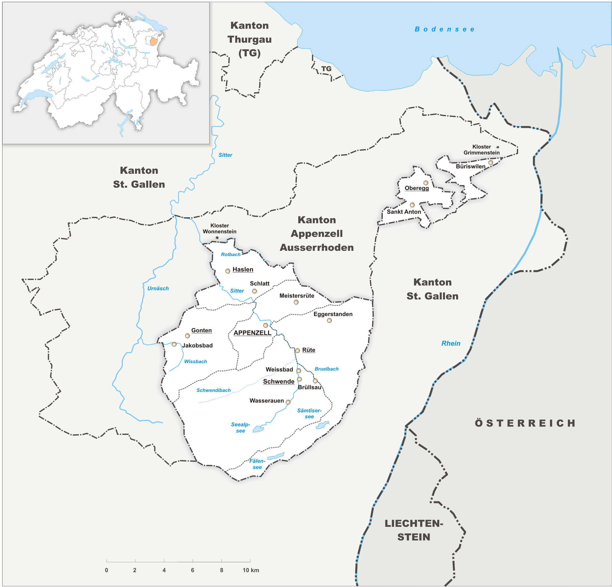
Deutsch: Karte des Kanton Appenzell Innerrhoden. |
||||||||
| Date | |||||||||
| Soorce | Ain wirk | ||||||||
| Author | Tschubby | ||||||||
| Permission (Reuisin this file) |
I, the copyright holder of this work, hereby publish it under the following licenses:
This file is licensed under the Creative Commons Attribution-Share Alike 2.5 Generic, 2.0 Generic and 1.0 Generic license.
Ye mey select the license o yer choice. |

File history
Clap oan ae date/time fer tae see the file aes it kithed at that time.
| Date/Time | Thummnail | Dimensions | Uiser | Comment | |
|---|---|---|---|---|---|
| current | 07:59, 26 Julie 2010 | | 2,066 × 1,980 (734 KB) | Tschubby | {{Information |Description= |Source= |Date= |Author= |Permission= |other_versions= }} |
| 20:59, 17 October 2009 |  | 2,066 × 1,980 (729 KB) | Tschubby | {{Information |Description= {{de| Karte des Kanton Appenzell Innerrhoden.}} |Source={{own}} |Date= 17.10.2009 |Author= Tschubby |Permission= {{self|GFDL|Cc-by-sa-3.0-migrated|Cc-by-sa-2.5,2.0,1.0} |
Eimage airtins
The'r nae pages airts tae this eimage.
Global file uisage
The follaein ither wikis uise this file:
- Uisage on ceb.wikipedia.org
- Uisage on en.wikipedia.org
- Uisage on it.wikipedia.org
- Uisage on ps.wikipedia.org
- Uisage on th.wikipedia.org
- Uisage on ur.wikipedia.org
- Uisage on vi.wikipedia.org
- Uisage on www.wikidata.org