File:Iran Iraq War Start Attack on Tehran Airport 1980-09-22.jpg

Size o this luikower: 800 × 530 pixels. Ither resolutions: 320 × 212 pixels | 640 × 424 pixels | 1,024 × 679 pixels | 1,280 × 849 pixels | 2,560 × 1,697 pixels | 3,130 × 2,075 pixels.
Oreeginal file (3,130 × 2,075 pixels, file size: 1.66 MB, MIME type: image/jpeg)
Ootline
| Descreeption |
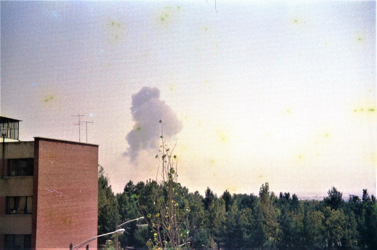
English: Iraqi forces attacked many locations including Tehran on Monday September 22, 1980. Around 14:15 explosions were heard from Mehrabad airport in Tehran. The picture was taken a few minutes after the explosions from north-west of the airport from a distance of about 7 kilometers (4.3 miles).
فارسی: نیروهای عراقی در روز دوشنبه سی و یکم شهریورماه ۱۳۵۹ به مناطق مختلف از جمله تهران حمله کردند. حدود ساعت دو و ربع بعدازظهر صدای انفجار از طرف فرودگاه مهرآباد در تهران شنیده شد. این عکس چند دقیقه بعد از وقوع انفجار از فاصله حدودا هفت کیلومتری از سمت شمال غرب فرودگاه گرفته شده است
|
| Date | |
| Soorce | Ain wirk |
| Author | Mhsheikholeslami |
| Camera location | | View this and other nearby images on: OpenStreetMap |
|---|
Licensin
Mhsheikholeslami
I, the copyright holder of this work, hereby publish it under the following license:
This file is licensed under the Creative Commons Attribution-Share Alike 4.0 International license.
Attribution: Mhsheikholeslami
- Ye are free:
- tae share – tae copy, distribute an transmit the wirk
- tae remix – tae adapt the wirk
- Unner the follaein condeetions:
- attribution – Ye must attribute the wirk in the manner specified bi the author or licensor (but nae in ony way that suggests that thay endorse ye or yer uise o the wirk).
- share alik – If ye alter, transform, or big upon this wirk, ye mey distribute the resultin wirk anly unner the same or seemilar license tae this ane.
File history
Clap oan ae date/time fer tae see the file aes it kithed at that time.
| Date/Time | Thummnail | Dimensions | Uiser | Comment | |
|---|---|---|---|---|---|
| current | 02:48, 5 September 2020 | | 3,130 × 2,075 (1.66 MB) | Mhsheikholeslami | Uploaded own work with UploadWizard |
Eimage airtins
The follaein pages airts tae this image:
Global file uisage
The follaein ither wikis uise this file:
- Uisage on af.wikipedia.org
- Uisage on ar.wikipedia.org
- Uisage on arz.wikipedia.org
- Uisage on ast.wikipedia.org
- Uisage on azb.wikipedia.org
- Uisage on az.wikipedia.org
- Uisage on ba.wikipedia.org
- Uisage on bcl.wikipedia.org
- Uisage on be.wikipedia.org
- Uisage on bg.wikipedia.org
- Uisage on bn.wikipedia.org
- Uisage on bs.wikipedia.org
- Uisage on ca.wikipedia.org
- Uisage on ckb.wikipedia.org
- Uisage on cs.wikipedia.org
- Uisage on cy.wikipedia.org
- Uisage on da.wikipedia.org
- Uisage on de.wikipedia.org
- Uisage on dv.wikipedia.org
- Uisage on el.wikipedia.org
- Uisage on en.wikipedia.org
- Uisage on eo.wikipedia.org
- Uisage on es.wikipedia.org
- Uisage on et.wikipedia.org
- Uisage on eu.wikipedia.org
- Uisage on fa.wikipedia.org
- Uisage on fi.wikipedia.org
- Uisage on fo.wikipedia.org
- Uisage on fr.wikipedia.org
- Uisage on ga.wikipedia.org
- Uisage on he.wikipedia.org
- Uisage on hi.wikipedia.org
- Uisage on hu.wikipedia.org
- Uisage on hy.wikipedia.org
- Uisage on id.wikipedia.org
- Uisage on io.wikipedia.org
View mair global usage o this file.