File:Egypt relief location map.jpg

Size o this luikower: 650 × 599 pixels. Ither resolutions: 260 × 240 pixels | 520 × 480 pixels | 833 × 768 pixels | 1,055 × 973 pixels.
Oreeginal file (1,055 × 973 pixels, file size: 459 KB, MIME type: image/jpeg)
Ootline
| Descreeption |
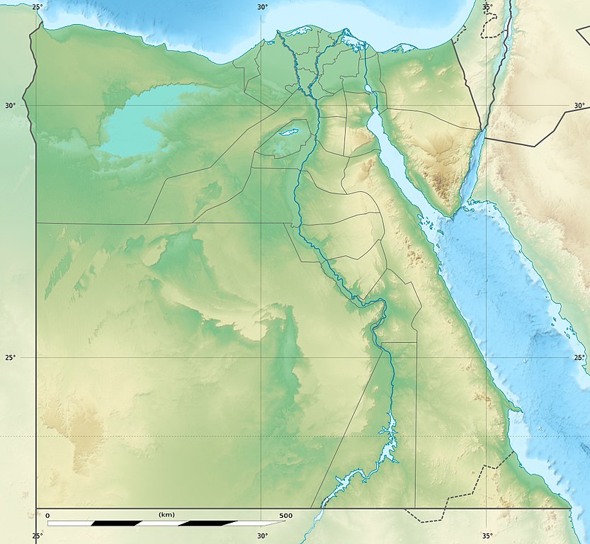
Deutsch: Relief Positionskarte von Ägypten
English: Physical location map of Egypt.
Français : Carte physique vierge destinée à la géolocalisation de l'Égypte telle que depuis le 14 avril 2011 suite à la dissolution des gouvernorats du 6 Octobre et de Helwan. Topographic scale: 1:4,932,000 (precision: 1,233 m)
Geographic limits of the map:
|
||
| Date | 2010-03, updated 2014-06 | ||
| Soorce |
Topographic background map: Own work
|
||
| Author | Eric Gaba (Sting - fr:Sting) and NordNordWest | ||
| Permission (Reuisin this file) |
|
||
| Other versions |
Derivative works of this file: Lower Egypt ancient nomes position map.jpg
|


| Camera location | | View this and other nearby images on: OpenStreetMap |
|---|

|
This map has been made or improved in the German Kartenwerkstatt (Map Lab). You can propose maps to improve as well.
|
Licensin
I, the copyright holder of this work, hereby publish it under the following licenses:

|
Permission is grantit tae copy, distribute an/or modify this document unner the terms o the GNU Free Documentation License, Version 1.2 or ony later version published bi the Free Software Foundation; wi no Invariant Sections, no Front-Cover Texts, an no Back-Cover Texts. A copy o the license is includit in the section enteetled GNU Free Documentation License. |
This file is licensed unner the Creative Commons Attribution-Share Alike 3.0 Unported license.
- Ye are free:
- tae share – tae copy, distribute an transmit the wirk
- tae remix – tae adapt the wirk
- Unner the follaein condeetions:
- attribution – Ye must attribute the wirk in the manner specified bi the author or licensor (but nae in ony way that suggests that thay endorse ye or yer uise o the wirk).
- share alik – If ye alter, transform, or big upon this wirk, ye mey distribute the resultin wirk anly unner the same or seemilar license tae this ane.
Ye mey select the license o yer choice.
File history
Clap oan ae date/time fer tae see the file aes it kithed at that time.
| Date/Time | Thummnail | Dimensions | Uiser | Comment | |
|---|---|---|---|---|---|
| current | 14:01, 18 August 2017 | | 1,055 × 973 (459 KB) | Mélomène | According with [https://en.wikipedia.org/wiki/Hala%27ib_Triangle] |
| 19:53, 13 Juin 2014 |  | 1,055 × 973 (450 KB) | Sting | Color profile | |
| 19:43, 13 Juin 2014 |  | 1,055 × 973 (422 KB) | Sting | Updated Governorates borders shape | |
| 13:59, 18 Apryle 2011 |  | 1,055 × 975 (415 KB) | Sting | Updated after Governorats dissolution | |
| 13:30, 19 Julie 2010 |  | 1,055 × 973 (451 KB) | Sting | Color profile | |
| 19:04, 7 Mairch 2010 |  | 1,055 × 973 (450 KB) | Sting | == {{int:filedesc}} == {{Location|26|42|00|N|30|45|00|E|scale:10000000}} <br/> {{Information |Description= {{de|Relief Positionskarte von Ägypten}} {{en|Physical location map of Egypt.}} {{fr|Carte physique vierge de l'[[:f |
Eimage airtins
The follaein pages airts tae this image:
Global file uisage
The follaein ither wikis uise this file:
- Uisage on als.wikipedia.org
- Uisage on ar.wikipedia.org
- Uisage on arz.wikipedia.org
- Uisage on ast.wikipedia.org
- Mar Roxu
- Canal de Suez
- Colosos de Coptos
- Faru d'Alexandría
- Muséu Exipcianu d'El Cairu
- Pirámides d'Exiptu
- Presa d'Asuán
- El Cairu
- Columna de Pompeyo
- Templu de Ramsés II (Abu Simbel)
- Módulu:Mapa de llocalización/datos/Exiptu
- Menfis
- Valle de los Reis
- Ilesia ortodoxa d'Alexandría
- Canal de los Faraones
- Biblioteca d'Alexandría
- Universidá d'al-Azhar
- Universidá d'El Cairu
- Alexandría
- Golfu d'Áqaba
- Gran Pirámide de Guiza
- Catacumbes de Kom el Shogafa
- Ciudadela d'El Cairu
- Península del Sinaí
- Abu Simbel
- Bibliotheca Alexandrina
- Templu d'Edfu
- Módulu:Mapa de llocalización/datos/Exiptu/usu
- Estadiu Internacional d'El Cairu
- KV63
- Damieta
- Cueva de les Besties
- Elefantina
- Gran Muséu Exipciu
View mair global usage o this file.