File:Croatia location map.svg

Size of this PNG preview of this SVG file: 619 × 599 pixels. Ither resolutions: 248 × 240 pixels | 496 × 480 pixels | 793 × 768 pixels | 1,058 × 1,024 pixels | 2,116 × 2,048 pixels | 1,097 × 1,062 pixels.
Oreeginal file (SVG file, nominallie 1,097 × 1,062 pixels, file size: 480 KB)
Ootline
| Descreeption |
Deutsch: Positionskarte von Kroatien
Quadratische Plattkarte, N-S-Streckung 140 %. Geographische Begrenzung der Karte:
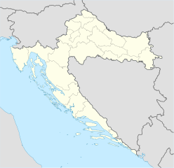
English: Location map of Croatia
Equirectangular projection, N/S stretching 140 %. Geographic limits of the map:
|
| Date | |
| Soorce | own work, using United States National Imagery and Mapping Agency data |
| Author | NordNordWest |
| Other versions |
Derivative works of this file: |

|
This map has been made or improved in the German Kartenwerkstatt (Map Lab). You can propose maps to improve as well.
|
Licensin
I, the copyright holder of this work, hereby publish it under the following licenses:

|
Permission is grantit tae copy, distribute an/or modify this document unner the terms o the GNU Free Documentation License, Version 1.2 or ony later version published bi the Free Software Foundation; wi no Invariant Sections, no Front-Cover Texts, an no Back-Cover Texts. A copy o the license is includit in the section enteetled GNU Free Documentation License. |
This file is licensed unner the Creative Commons Attribution-Share Alike 3.0 Unported license.
- Ye are free:
- tae share – tae copy, distribute an transmit the wirk
- tae remix – tae adapt the wirk
- Unner the follaein condeetions:
- attribution – Ye must attribute the wirk in the manner specified bi the author or licensor (but nae in ony way that suggests that thay endorse ye or yer uise o the wirk).
- share alik – If ye alter, transform, or big upon this wirk, ye mey distribute the resultin wirk anly unner the same or seemilar license tae this ane.
Ye mey select the license o yer choice.
File history
Clap oan ae date/time fer tae see the file aes it kithed at that time.
| Date/Time | Thummnail | Dimensions | Uiser | Comment | |
|---|---|---|---|---|---|
| current | 08:00, 29 August 2008 | | 1,097 × 1,062 (480 KB) | NordNordWest | |
| 15:54, 30 Julie 2008 |  | 548 × 531 (412 KB) | NordNordWest | more detailed borderlines | |
| 16:55, 16 Julie 2008 |  | 548 × 531 (454 KB) | NordNordWest | {{Information |Description= {{de|Positionskarte von Kroatien}} Quadratische Plattkarte, N-S-Streckung 140 %. Geographische Begrenzung der Karte: * N: 46.8° N * S: 42.1° N * W: 13.1° O * O: 19.9° O {{en|Location map of [[:en:Croatia|Cr |
Eimage airtins
The follaein pages airts tae this image:
Global file uisage
The follaein ither wikis uise this file:
- Uisage on ab.wikipedia.org
- Uisage on af.wikipedia.org
- Uisage on als.wikipedia.org
- Uisage on am.wikipedia.org
- Uisage on an.wikipedia.org
- Uisage on ar.wikipedia.org
- قالب:خريطة مواقع
- قالب:خريطة مواقع كرواتيا
- قالب:خريطة مواقع/شرح
- بطولة أوروبا لكرة الصالات 2012
- قالب:خريطة مواقع/ملعب
- قالب:Location map/sandbox quick/doc
- وحدة:Location map/data/Croatia
- وحدة:Location map/data/Croatia/شرح
- اشتباك باكراتش
- حادثة بحيرات بليتفيتش
- معركة بوروفو سيلو
- حصار كييفو (1991)
- عملية العاصفة (حرب البوسنة والهرسك)
- Uisage on arz.wikipedia.org
- Uisage on ast.wikipedia.org
View mair global usage o this file.