File:China Xinjiang adm location map.svg

Oreeginal file (SVG file, nominallie 2,220 × 1,939 pixels, file size: 485 KB)
Ootline
| Descreeption |
Deutsch: Positionskarte von Xinjiang, Volksrepublik China
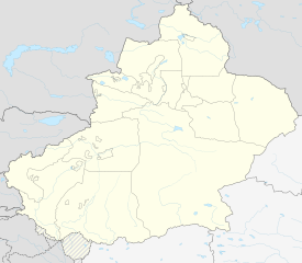
English: Location map of Xinjiang, People's Republic of China
|
||||||||||||
| Date | |||||||||||||
| Soorce |
Own work using:
|
||||||||||||
| Author | NordNordWest | ||||||||||||
| Other versions |
|
||||||||||||
| SVG genesis | This world map was created with Adobe Illustrator.
|
||||||||||||


Licensin
Usage of this file with:

explanatory notes: Legally binding is only the full legalcode. For a free usage I recommend to respect the following licence conditions:
1. Provide my name as given above: NordNordWest,
2. a copy of, or the URI for, the applicable license: https://creativecommons.org/licenses/by-sa/3.0/de/legalcode,
3. the title of the work,
4. in the case of an adaptation, a credit identifying the use of the work in the adaptation.
This license and the rights granted hereunder will terminate automatically upon any breach by you of the terms of this license. Any of the above conditions can be waived if you get permission from the copyright holder. If you have questions or wish differing conditions, please contact me through nnwest or my discussion page ![]() t-online.de
t-online.de
- Ye are free:
- tae share – tae copy, distribute an transmit the wirk
- tae remix – tae adapt the wirk
- Unner the follaein condeetions:
- attribution – Ye must attribute the wirk in the manner specified bi the author or licensor (but nae in ony way that suggests that thay endorse ye or yer uise o the wirk).
- share alik – If ye alter, transform, or big upon this wirk, ye mey distribute the resultin wirk anly unner the same or seemilar license tae this ane.

File history
Clap oan ae date/time fer tae see the file aes it kithed at that time.
| Date/Time | Thummnail | Dimensions | Uiser | Comment | |
|---|---|---|---|---|---|
| current | 20:06, 14 Februar 2020 | | 2,220 × 1,939 (485 KB) | NordNordWest | == {{int:filedesc}} == {{Information |Description= {{de|1=Positionskarte von Xinjiang, Volksrepublik China}} {{en|1=Location map of Xinjiang, People's Republic of China}} {{Location map series N |stretching=135 |top=49.4 |bottom=34.2 |left=73.2 |right=96.7 }} |Source={{Own using}} * United States National Imagery and Mapping Agency data * World Data Base II data |Date=2020-02-14 |Author={{U|NordNordWest}} |Permission= |other_versions=<gallery>China Xinjiang rel location map.svg</gallery> }} {... |
Eimage airtins
The follaein pages airts tae this image:
Global file uisage
The follaein ither wikis uise this file:
- Uisage on bn.wikipedia.org
- Uisage on cdo.wikipedia.org
- Uisage on cv.wikipedia.org
- Uisage on de.wikipedia.org
- Uisage on en.wikipedia.org
- Tashkurgan Tajik Autonomous County
- Shihezi
- Tacheng
- Aral, Xinjiang
- Ürümqi Diwopu International Airport
- Wujiaqu
- Qapqal Xibe Autonomous County
- Burqin County
- Qinggil County
- Jeminay County
- Yumin County
- Shawan, Xinjiang
- Toli County
- Emin County
- Xinhe County, Xinjiang
- Kalpin County
- Awat County
- Baicheng County
- Kargilik County
- Yopurga County
- Makit County
- Ulugqat County
View mair global usage o this file.