File:China Inner Mongolia location map.svg

Size of this PNG preview of this SVG file: 577 × 433 pixels. Ither resolutions: 320 × 240 pixels | 640 × 480 pixels | 1,024 × 768 pixels | 1,280 × 961 pixels | 2,560 × 1,921 pixels.
Oreeginal file (SVG file, nominallie 577 × 433 pixels, file size: 366 KB)
Ootline
| Descreeption |
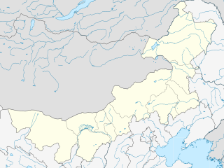
English: Location map of Inner Mongolia, People's Republic of China
Equirectangular projection, N/S stretching 141 %. True scale parallel: 45°00' N. Geographic limits of the map:
|
| Date | |
| Soorce |
Ain wirk, using
|
| Author | Das steinerne Herz |
| Other versions |
Derivative works of this file: |
.svg)
Licensin
I, the copyright holder of this work, hereby publish it under the following licenses:
This file is licensed unner the Creative Commons Attribution-Share Alike 3.0 Unported license.
- Ye are free:
- tae share – tae copy, distribute an transmit the wirk
- tae remix – tae adapt the wirk
- Unner the follaein condeetions:
- attribution – Ye must attribute the wirk in the manner specified bi the author or licensor (but nae in ony way that suggests that thay endorse ye or yer uise o the wirk).
- share alik – If ye alter, transform, or big upon this wirk, ye mey distribute the resultin wirk anly unner the same or seemilar license tae this ane.

|
Permission is grantit tae copy, distribute an/or modify this document unner the terms o the GNU Free Documentation License, Version 1.2 or ony later version published bi the Free Software Foundation; wi no Invariant Sections, no Front-Cover Texts, an no Back-Cover Texts. A copy o the license is includit in the section enteetled GNU Free Documentation License. |
Ye mey select the license o yer choice.
File history
Clap oan ae date/time fer tae see the file aes it kithed at that time.
| Date/Time | Thummnail | Dimensions | Uiser | Comment | |
|---|---|---|---|---|---|
| current | 21:56, 20 Februar 2011 | | 577 × 433 (366 KB) | Das steinerne Herz | completly new version |
| 19:55, 13 Februar 2011 |  | 663 × 500 (2.21 MB) | Das steinerne Herz | trying to correct | |
| 14:14, 10 Februar 2011 |  | 664 × 508 (2.21 MB) | Das steinerne Herz | cropping | |
| 08:02, 10 Februar 2011 |  | 748 × 605 (2.16 MB) | Das steinerne Herz | correction | |
| 18:54, 9 Februar 2011 |  | 748 × 605 (2.17 MB) | Das steinerne Herz | {{Information |Description ={{en|1=Location map of Inner Mongolia, People's Republic of China Equirectangular projection, N/S stretching 141 %. Geographic limits of the map: * N: 55.0° N * S: 3 |
Eimage airtins
The follaein pages airts tae this image:
Global file uisage
The follaein ither wikis uise this file:
- Uisage on ar.wikipedia.org
- Uisage on azb.wikipedia.org
- Uisage on ba.wikipedia.org
- Uisage on bg.wikipedia.org
- Uisage on bn.wikipedia.org
- Uisage on ceb.wikipedia.org
- Uisage on cv.wikipedia.org
- Uisage on de.wikipedia.org
- Uisage on en.wikipedia.org
- Hohhot
- Battles of Khalkhin Gol
- Wuhai
- Chifeng
- Hulunbuir
- Hailar District
- Zalantun
- Ulanqab
- Jining District
- Fengzhen
- Xilinhot
- Hanggai (village)
- Dorbod Banner
- Manzhouli
- Dolon Nor
- Linhe District
- Ewenki Autonomous Banner
- Oroqen Autonomous Banner
- Five Pagoda Temple (Hohhot)
- Solun, Horqin Right Front Banner
- Yakeshi
- Dongsheng District
- Wuchuan County, Inner Mongolia
- Erenhot
- Baotou Donghe Airport
- Chifeng Yulong Airport
- Hulunbuir Hailar Airport
- Hohhot Baita International Airport
- Manzhouli Xijiao Airport
- Tongliao Airport
- Ulanhot Yilelite Airport
- Wuhai Airport
- Xilinhot Airport
- Bayannur
- Tsondol
- Ejin Horo Banner
View mair global usage o this file.