File:Canaldoddaghatta.jpg
Size o this luikower: 337 × 599 pixels. Ither resolutions: 135 × 240 pixels | 270 × 480 pixels | 432 × 768 pixels | 576 × 1,024 pixels | 1,728 × 3,072 pixels.
Oreeginal file (1,728 × 3,072 pixels, file size: 1.07 MB, MIME type: image/jpeg)
Ootline
| Descreeption |
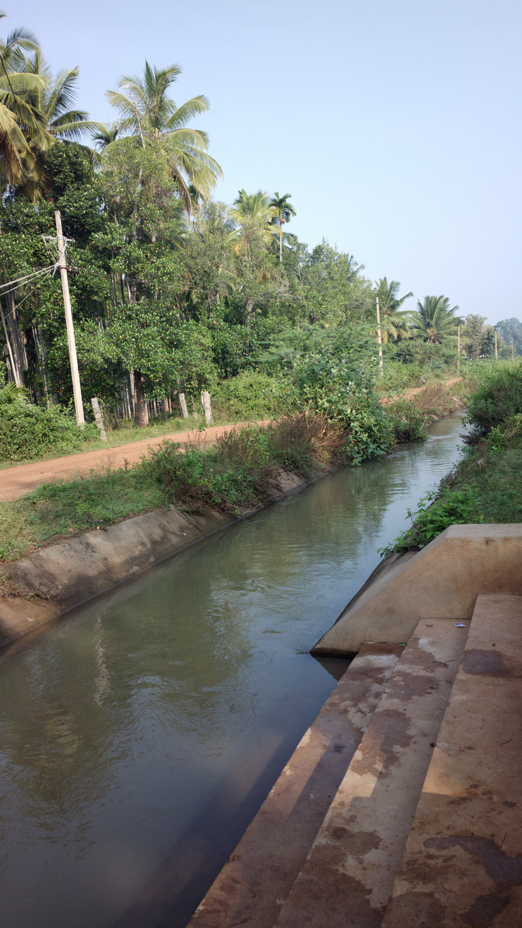
English: Irrigation Canal in Doddaghatta Village near Channagiri. |
| Date | |
| Soorce | Ain wirk |
| Author | Irrigator |
| Camera location | | View this and other nearby images on: OpenStreetMap |
|---|
Licensin
I, the copyright holder of this work, hereby publish it under the following license:
This file is licensed unner the Creative Commons Attribution-Share Alike 3.0 Unported license.
- Ye are free:
- tae share – tae copy, distribute an transmit the wirk
- tae remix – tae adapt the wirk
- Unner the follaein condeetions:
- attribution – Ye must attribute the wirk in the manner specified bi the author or licensor (but nae in ony way that suggests that thay endorse ye or yer uise o the wirk).
- share alik – If ye alter, transform, or big upon this wirk, ye mey distribute the resultin wirk anly unner the same or seemilar license tae this ane.
File history
Clap oan ae date/time fer tae see the file aes it kithed at that time.
| Date/Time | Thummnail | Dimensions | Uiser | Comment | |
|---|---|---|---|---|---|
| current | 03:07, 18 November 2012 | | 1,728 × 3,072 (1.07 MB) | Irrigator | User created page with UploadWizard |
Eimage airtins
The'r nae pages airts tae this eimage.
Global file uisage
The follaein ither wikis uise this file:
- Uisage on de.wikipedia.org
- Uisage on en.wikipedia.org
- Uisage on hr.wikipedia.org
- Uisage on ilo.wikipedia.org
- Uisage on kn.wikipedia.org
- Uisage on pa.wikipedia.org
- Uisage on sh.wikipedia.org
- Uisage on sr.wikipedia.org
- Uisage on su.wikipedia.org
- Uisage on te.wikipedia.org
- Uisage on tl.wikipedia.org
- Uisage on yi.wikipedia.org