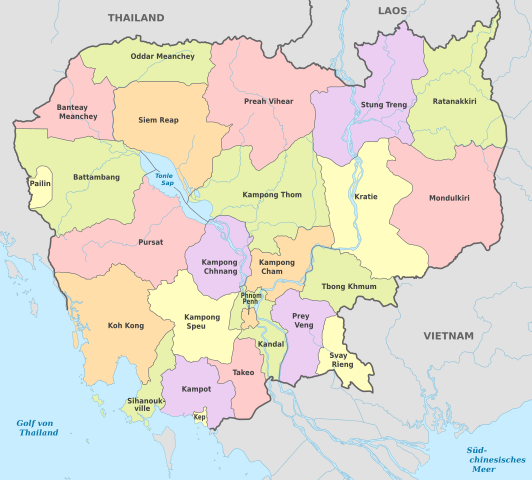
File:Cambodia, administrative divisions - de - colored, 2013.svg

Size of this PNG preview of this SVG file: 664 × 599 pixels. Ither resolutions: 266 × 240 pixels | 532 × 480 pixels | 851 × 768 pixels | 1,134 × 1,024 pixels | 2,269 × 2,048 pixels | 1,346 × 1,215 pixels.
Oreeginal file (SVG file, nominallie 1,346 × 1,215 pixels, file size: 869 KB)
Ootline


.svg)


_(Paris_zoom).svg)
.svg)
,_administrative_divisions_-_de_-_colored_(multizoom).svg)
_-_colored.svg)
.svg)
,_administrative_divisions_-_Nmbrs_(multizoom).svg)
,_administrative_divisions_-_de_-_colored.svg)
_-_de_-_colored.svg)

.svg)

.svg)
Licensin
I, the copyright holder of this work, hereby publish it under the following licenses:
This file is licensed under the Creative Commons Attribution-Share Alike 3.0 Germany license.
- Ye are free:
- tae share – tae copy, distribute an transmit the wirk
- tae remix – tae adapt the wirk
- Unner the follaein condeetions:
- attribution – Ye must attribute the wirk in the manner specified bi the author or licensor (but nae in ony way that suggests that thay endorse ye or yer uise o the wirk).
- share alik – If ye alter, transform, or big upon this wirk, ye mey distribute the resultin wirk anly unner the same or seemilar license tae this ane.

This file is licensed under the Creative Commons Attribution-Share Alike 3.0 Austria license.
- Ye are free:
- tae share – tae copy, distribute an transmit the wirk
- tae remix – tae adapt the wirk
- Unner the follaein condeetions:
- attribution – Ye must attribute the wirk in the manner specified bi the author or licensor (but nae in ony way that suggests that thay endorse ye or yer uise o the wirk).
- share alik – If ye alter, transform, or big upon this wirk, ye mey distribute the resultin wirk anly unner the same or seemilar license tae this ane.

Ye mey select the license o yer choice.
File history
Clap oan ae date/time fer tae see the file aes it kithed at that time.
| Date/Time | Thummnail | Dimensions | Uiser | Comment | |
|---|---|---|---|---|---|
| current | 19:08, 15 November 2015 | | 1,346 × 1,215 (869 KB) | Man77 | fix |
| 18:42, 15 November 2015 |  | 1,346 × 1,215 (869 KB) | Man77 | +Laos | |
| 18:10, 15 November 2015 |  | 1,346 × 1,215 (866 KB) | Man77 | fix | |
| 18:01, 15 November 2015 |  | 1,346 × 1,215 (865 KB) | Man77 | == {{int:filedesc}} == {{Information |Description={{de|Karte der politischen Gliederung Kambodschas seit 31. Dezember 2013}} {{en|Map of administrative divisions of Cambodia as of December 31st, 2013}} |Source={{own}}{{Inkscape}}{{AttribSVG|Cambodia S... |
Eimage airtins
The follaein pages airts tae this image:
Global file uisage
The follaein ither wikis uise this file:
- Uisage on de.wikipedia.org
- Uisage on en.wikipedia.org
- Uisage on es.wikipedia.org
- Uisage on hu.wiktionary.org
- Uisage on it.wikipedia.org
- Uisage on pt.wikipedia.org