File:Bratislava Region - physical map.png

Size o this luikower: 494 × 600 pixels. Ither resolutions: 198 × 240 pixels | 560 × 680 pixels.
Oreeginal file (560 × 680 pixels, file size: 1.09 MB, MIME type: image/png)
| Descreeption |
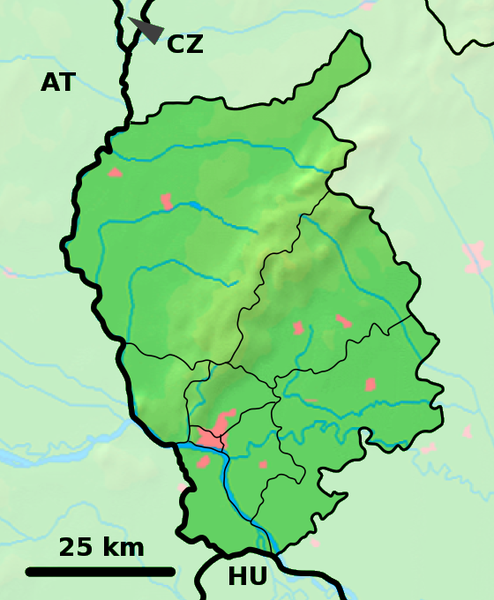
Background map of the Bratislava Region, Slovakia, ready for the Geobox template, calibrated at en:Template:Geobox locator Bratislava Region Outline map of the Bratislava Region, Slovakia, ready for the Geobox template, calibrated at en:Template:Geobox locator Bratislava Region |
| Date | (UTC) |
| Soorce | |
| Author |
|
| This is a retouched picture, which means that it has been digitally altered from its original version. Modifications: fusion. The original can be viewed here: Bratislava Region - outline map.svg:
|
This file is licensed unner the Creative Commons Attribution-Share Alike 3.0 Unported license.
- Ye are free:
- tae share – tae copy, distribute an transmit the wirk
- tae remix – tae adapt the wirk
- Unner the follaein condeetions:
- attribution – Ye must attribute the wirk in the manner specified bi the author or licensor (but nae in ony way that suggests that thay endorse ye or yer uise o the wirk).
- share alik – If ye alter, transform, or big upon this wirk, ye mey distribute the resultin wirk anly unner the same or seemilar license tae this ane.
Original upload log
This image is a derivative work of the following images:
- File:Bratislava_Region_-_background_map.png licensed with PD-Demis
- 2007-10-28T23:14:11Z Caroig 560x680 (333118 Bytes) fixing alignment
- 2007-10-27T19:44:14Z Caroig 560x680 (335827 Bytes) == Summary == {{Information |Description=Background map of the Bratislava Region, Slovakia, ready for the [[:en:Template:Geobox|Geobox]] template, calibrated at [[:en:Template:Geobox locator Bratislava Region]] |Source=Made m
- File:Bratislava_Region_-_outline_map.svg licensed with Cc-by-sa-3.0,2.5,2.0,1.0, GFDL
- 2007-10-27T19:47:14Z Caroig 700x850 (120252 Bytes) == Summary == {{Information |Description=Outline map of the Bratislava Region, Slovakia, ready for the [[:en:Template:Geobox|Geobox]] template, calibrated at [[:en:Template:Geobox locator Bratislava Region]] |Source=self-made
Uploaded with derivativeFX
File history
Clap oan ae date/time fer tae see the file aes it kithed at that time.
| Date/Time | Thummnail | Dimensions | Uiser | Comment | |
|---|---|---|---|---|---|
| current | 18:01, 19 September 2010 | | 560 × 680 (1.09 MB) | Adehertogh | {{Information |Description=Background map of the Bratislava Region, Slovakia, ready for the Geobox template, calibrated at en:Template:Geobox locator Bratislava Region Outline map of the Bratislava Region, Slovakia, ready for |
Eimage airtins
The follaein pages airts tae this image:
Global file uisage
The follaein ither wikis uise this file:
- Uisage on bg.wikipedia.org
- Uisage on en.wikipedia.org
- Pezinok
- Gajary
- Malacky
- Petržalka
- Modra
- Svätý Jur
- Dunajská Lužná
- Senec, Slovakia
- Vysoká pri Morave
- Jakubov
- Kostolište
- Suchohrad
- Jablonové, Malacky District
- Pernek
- Kuchyňa
- Rusovce
- Jarovce
- Blatné
- Rohožník, Malacky District
- Borinka
- Zohor
- Láb
- Lozorno
- Marianka
- Plavecké Podhradie
- Plavecký Mikuláš
- Plavecký Štvrtok
- Sološnica
- Studienka
- Veľké Leváre
- Závod, Slovakia
- Budmerice
- Báhoň
- Doľany, Pezinok District
- Dubová, Pezinok District
- Jablonec, Pezinok District
- Slovenský Grob
- Vinosady
- Limbach, Slovakia
- Viničné
- Vištuk
- Štefanová, Pezinok District
- Šenkvice
- Častá
- Bernolákovo
- Boldog, Slovakia
View mair global usage o this file.