File:Blanco Bay.png

Oreeginal file (1,140 × 745 pixels, file size: 92 KB, MIME type: image/png)
Ootline
| Descreeption |
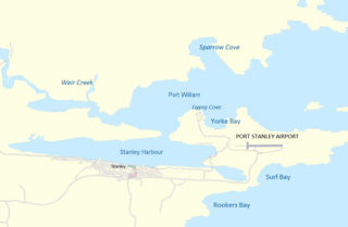
English: Map of the Port Stanley, Falklands area |
| Date | |
| Soorce | http://www.maps-for-free.com/ |
| Author | Modified by Dr. Blofeld |
| Permission (Reuisin this file) |
http://www.maps-for-free.com/html/about.html |

|
File:Stanley and Stanley Harbour.svg is a vector version o this file. It should be uised in place o this raster image when nae inferior.
File:Blanco Bay.png → File:Stanley and Stanley Harbour.svg
For mair information, see Help:SVG. |
 |
|
|
File:Stanley - Port, airport and Yorke Bay.svg is a vector version o this file. It should be uised in place o this raster image when nae inferior.
File:Blanco Bay.png → File:Stanley - Port, airport and Yorke Bay.svg
For mair information, see Help:SVG. |
 |
Licensin
This screenshot either does not contain copyright-eligible parts or visuals of copyrighted software, or the author has released it under a free license (which should be indicated beneath this notice), and as such follows the licensing guidelines for screenshots of Wikimedia Commons. You may use it freely according to its particular license. Free software license:

|
This work is free software; you can redistribute it and/or modify it under the terms of the GNU General Public License as published by the Free Software Foundation; either version 2 of the License, or any later version. This work is distributed in the hope that it will be useful, but without any warranty; without even the implied warranty of merchantability or fitness for a particular purpose. See version 2 and version 3 of the GNU General Public License for more details. |
Note: if the screenshot shows any work that is not a direct result of the program code itself, such as a text or graphics that are not part of the program, the license for that work must be indicated separately.
- Ye are free:
- tae share – tae copy, distribute an transmit the wirk
- tae remix – tae adapt the wirk
- Unner the follaein condeetions:
- attribution – Ye must attribute the wirk in the manner specified bi the author or licensor (but nae in ony way that suggests that thay endorse ye or yer uise o the wirk).
File history
Clap oan ae date/time fer tae see the file aes it kithed at that time.
| Date/Time | Thummnail | Dimensions | Uiser | Comment | |
|---|---|---|---|---|---|
| current | 18:26, 4 Juin 2020 | | 1,140 × 745 (92 KB) | Hohum | Cartographic colours |
| 11:21, 20 Mairch 2012 |  | 1,140 × 745 (2.43 MB) | Apcbg | Fixed toponymy. There is no 'Blanco Bay' in the Falklands toponymy, see the comprehensive [http://www.pcgn.org.uk/Falkland%20Islands-July2006.pdf relevant source]. The bay in question is 'Port William' ('Puerto Groussac' by Argentina). | |
| 11:22, 7 December 2011 |  | 1,140 × 745 (105 KB) | Blofeld Dr. | ||
| 11:13, 7 December 2011 |  | 1,140 × 745 (103 KB) | Blofeld Dr. | {{Information |Description ={{en|1=k}} |Source =k |Author =k |Date =k |Permission = |other_versions = }} |
Eimage airtins
The follaein pages airts tae this image:
Global file uisage
The follaein ither wikis uise this file:
- Uisage on ast.wikipedia.org
- Uisage on bn.wikipedia.org
- Uisage on ceb.wikipedia.org
- Uisage on en.wikipedia.org
- Uisage on es.wikipedia.org
- Uisage on fa.wikipedia.org
- Uisage on fr.wikipedia.org
- Uisage on he.wikipedia.org
- Uisage on hu.wikipedia.org
- Uisage on id.wikipedia.org
- Uisage on incubator.wikimedia.org
- Uisage on io.wikipedia.org
- Uisage on ml.wikipedia.org
- Uisage on nn.wikipedia.org
- Uisage on pt.wikipedia.org
- Uisage on sv.wikipedia.org
- Uisage on ta.wikipedia.org
- Uisage on th.wikipedia.org
- Uisage on www.wikidata.org
- Uisage on zh.wikipedia.org