File:Azerbaijan (orthographic projection).svg

Size of this PNG preview of this SVG file: 551 × 551 pixels. Ither resolutions: 240 × 240 pixels | 480 × 480 pixels | 768 × 768 pixels | 1,024 × 1,024 pixels | 2,048 × 2,048 pixels.
Oreeginal file (SVG file, nominallie 551 × 551 pixels, file size: 570 KB)
Ootline
| Descreeption |
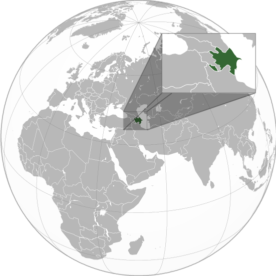
English: Orthographic Projection Map of Azerbaijan.
The other orthographic projection maps. .svg) |
| Date | |
| Soorce | Ain wirk |
| Author | en:User:Night w |
.svg)
.svg)
.svg)
.svg)
.svg)
.svg)
.svg)
.svg)
.svg)
.svg)
.svg)
.svg)
.svg)
.svg)
.svg)
.svg)
.svg)
.svg)
.svg)
.svg)
.svg)
.svg)
.svg)
.svg)
.svg)
.svg)
.svg)
.svg)
.svg)
.svg)
.svg)
.svg)
.svg)
.svg)
.svg)
.svg)
.svg)
.svg)
.svg)
.svg)
.svg)
.svg)
.svg)
.svg)
.svg)
.svg)
.svg)
.svg)
.svg)
.svg)
.svg)
.svg)
.svg)
.svg)
.svg)
.svg)
.svg)
.svg)
.svg)
.svg)
.svg)
.svg)
.svg)
.svg)
.svg)
.svg)
.svg)
.svg)
.svg)
.svg)
.svg)
.svg)
.svg)

.svg)

.svg)

.svg)
.svg)
.svg)
.svg)
.svg)
.svg)
.svg)


.svg)
.svg)
.svg)
.svg)
.svg)
.svg)
.svg)

.svg)
.svg)
.svg)
.svg)
.svg)
.svg)
.svg)
.svg)
.svg)

.svg)
.svg)
.svg)
.svg)
.svg)
.svg)
.svg)
_without_national_boundaries.svg)
.svg)
.svg)
.svg)
.svg)
.svg)
.svg)

.svg)
.svg)
.png)
.svg)
.svg)
.svg)
.svg)

.svg)
.svg)
.svg)
.svg)
.svg)
.svg)
.svg)
.svg)
.svg)
.svg)
.svg)

.svg)
.svg)
.svg)
.svg)
.svg)
.svg)
.svg)
.svg)
.svg)

.svg)
.svg)

.svg)
.svg)
.svg)
.svg)
.svg)
.svg)
.svg)
.svg)
.svg)
.svg)
.svg)
.svg)
.svg)
.svg)
.svg)
.svg)
.svg)
.svg)
.svg)
.svg)
.svg)
.svg)
.svg)
.svg)
.svg)
.svg)
.svg)
_-_Crimea_disputed.svg)
.svg)
.svg)
.svg)
.svg)
.svg)
.svg)
.svg)
.svg)
.svg)
.svg)
.svg)
_political.svg)
.svg)
.svg)
.svg)
.svg)
_-_Crimea_disputed_-_no_borders.svg)
.svg)
.svg)
.svg)
.svg)
.svg)
.svg)
.svg)
.svg)
.svg)
.svg)
.svg)

.svg)
.svg)
.svg)

.png)
.svg)
.svg)
.svg)
.svg)
.svg)
.svg)
.svg)
.svg)
.svg)
.svg)
.svg)
.svg)
.svg)
.svg)
.svg)
.svg)
.svg)
.svg)
.svg)
.svg)
.svg)
.svg)
.svg)
.svg)
.svg)
.svg)
.svg)
.svg)
.svg)
.svg)
.svg)
.svg)
.svg)
.svg)
.png)
.svg)
.svg)
.svg)
_(orthographic_projection).png)
.svg)
Licensin
I, the copyright holder of this work, hereby publish it under the following licenses:

|
Permission is grantit tae copy, distribute an/or modify this document unner the terms o the GNU Free Documentation License, Version 1.2 or ony later version published bi the Free Software Foundation; wi no Invariant Sections, no Front-Cover Texts, an no Back-Cover Texts. A copy o the license is includit in the section enteetled GNU Free Documentation License. |
This file is licensed unner the Creative Commons Attribution-Share Alike 3.0 Unported license.
- Ye are free:
- tae share – tae copy, distribute an transmit the wirk
- tae remix – tae adapt the wirk
- Unner the follaein condeetions:
- attribution – Ye must attribute the wirk in the manner specified bi the author or licensor (but nae in ony way that suggests that thay endorse ye or yer uise o the wirk).
- share alik – If ye alter, transform, or big upon this wirk, ye mey distribute the resultin wirk anly unner the same or seemilar license tae this ane.
Ye mey select the license o yer choice.
Original upload log
The original description page was on en.wikipedia (file log). All following user names refer to en.wikipedia.
.svg)
- 23:49, 20 April 2011 (UTC) Sisyphos23 551×551 (557 KB)
- 14:15, 15 April 2011 (UTC) Chipmunkdavis 551×551 (568 KB) (Sharpening smaller image)
- 09:57, 15 April 2011 (UTC) Dbachmann 551×551 (577 KB) (suggestion)
- 23:05, 14 April 2011 (UTC) Night w 551×551 (571 KB) (trying to colour)
- 22:58, 14 April 2011 (UTC) Night w 551×551 (575 KB) ({{Information |Description={{en|1=Azerbaijan}} |Source=Own work |Author=Night w |Date=2011-04 |Permission= |other_versions={{User:Ssolbergj/orthographic}} }} == {{int:license}} == {{self|cc-by-sa-3.0|GFDL|migration=redundant}} {{ImageNot)
File history
Clap oan ae date/time fer tae see the file aes it kithed at that time.
.svg&dir=prev)
.svg&offset=20160827021508)
.svg&offset=&limit=20)
.svg&offset=&limit=50)
.svg&offset=&limit=100)
.svg&offset=&limit=250)
.svg&offset=&limit=500)
| Date/Time | Thummnail | Dimensions | Uiser | Comment | |
|---|---|---|---|---|---|
| current | 01:36, 23 Mairch 2023 | | 551 × 551 (570 KB) | M.Bitton | Reverted to version as of 09:05, 14 September 2022 (UTC): per COM:OVERWRITE |
| 13:56, 22 Mairch 2023 |  | 689 × 689 (445 KB) | Multituberculata | ||
| 23:29, 16 September 2022 |  | 551 × 551 (570 KB) | M.Bitton | Reverted to version as of 09:05, 14 September 2022 (UTC): per COM:OVERWRITE | |
| 21:54, 16 September 2022 |  | 689 × 689 (445 KB) | Hogweard | Issues fixed - and South Sudan border added | |
| 09:05, 14 September 2022 |  | 551 × 551 (570 KB) | Toghrul R | Reverted to version as of 15:45, 29 August 2016 (UTC) the Middle East region and Europe were broken, reverting to the previous version without South Sudan; waiting for the fix | |
| 18:00, 13 December 2019 |  | 551 × 551 (421 KB) | Goran tek-en | Added border for South Sudan as requested by {{u|Maphobbyist}} | |
| 15:45, 29 August 2016 |  | 551 × 551 (570 KB) | Artoxx | Reverted to version as of 15:31, 19 April 2016 (UTC) | |
| 15:44, 29 August 2016 |  | 551 × 551 (190 KB) | Artoxx | Reverted to version as of 02:15, 27 August 2016 (UTC) | |
| 02:16, 27 August 2016 |  | 551 × 551 (190 KB) | MosMusy | Georgia and Moldova have their main maps with territories not under control shaded. | |
| 02:15, 27 August 2016 |  | 551 × 551 (190 KB) | MosMusy | Moldova and Georgia's map all have shading for territory not under their government's control. |
Eimage airtins
The follaein pages airts tae this image:
Global file uisage
The follaein ither wikis uise this file:
- Uisage on af.wikipedia.org
- Uisage on ami.wikipedia.org
- Uisage on arc.wikipedia.org
- Uisage on ar.wikipedia.org
- قائمة الدول ذات السيادة والأقاليم التابعة في آسيا
- مستخدم:جار الله/قائمة صور مقالات العلاقات الثنائية
- العلاقات الأذربيجانية الأمريكية
- العلاقات الأذربيجانية الأنغولية
- العلاقات الأذربيجانية الكورية الجنوبية
- العلاقات الأذربيجانية الإريترية
- العلاقات الأذربيجانية السويسرية
- العلاقات الأذربيجانية الألمانية
- العلاقات الأذربيجانية الليختنشتانية
- العلاقات الأذربيجانية البوليفية
- العلاقات الأذربيجانية الموزمبيقية
- العلاقات الأذربيجانية الألبانية
- العلاقات الأذربيجانية البلجيكية
- العلاقات الأذربيجانية الإثيوبية
- العلاقات الأذربيجانية البيلاروسية
- العلاقات الأذربيجانية الطاجيكستانية
- العلاقات الأذربيجانية الرومانية
- العلاقات الأذربيجانية الأرجنتينية
- العلاقات الأذربيجانية الغامبية
- العلاقات الأذربيجانية القبرصية
- العلاقات الأذربيجانية السيراليونية
- العلاقات الأذربيجانية النيبالية
- العلاقات الأذربيجانية الليبيرية
- العلاقات الأذربيجانية التشيكية
- العلاقات الأذربيجانية الميانمارية
- العلاقات الأذربيجانية الكندية
- العلاقات الأذربيجانية الزيمبابوية
- العلاقات الأذربيجانية البالاوية
- العلاقات الأذربيجانية النيجيرية
- العلاقات الأذربيجانية اليمنية
- العلاقات الأذربيجانية الفانواتية
- العلاقات الأذربيجانية الغابونية
- العلاقات الأذربيجانية البنمية
- العلاقات الأذربيجانية الكوبية
- العلاقات الأذربيجانية الجورجية
- العلاقات الأذربيجانية التونسية
- العلاقات الأذربيجانية الكورية الشمالية
- العلاقات الأذربيجانية الهندية
- العلاقات الأذربيجانية اليابانية
- العلاقات الأذربيجانية الإيطالية
- العلاقات الأذربيجانية الناوروية
- العلاقات الأذربيجانية الأسترالية
- العلاقات الأذربيجانية الزامبية
- العلاقات الأذربيجانية الفيجية
- العلاقات الأذربيجانية المارشالية
- العلاقات الأذربيجانية المالية
View mair global usage o this file.
.svg)
.svg)