File:Austria Salzburg location map.svg

Size of this PNG preview of this SVG file: 700 × 600 pixels. Ither resolutions: 280 × 240 pixels | 560 × 480 pixels | 896 × 768 pixels | 1,195 × 1,024 pixels | 2,389 × 2,048 pixels | 1,071 × 918 pixels.
Oreeginal file (SVG file, nominallie 1,071 × 918 pixels, file size: 988 KB)
Ootline
| Descreeption |
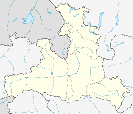
Deutsch: Positionskarte von Salzburg
Quadratische Plattkarte. Geographische Begrenzung der Karte:
English: Location map of Salzburg
Equirectangular projection. Geographic limits of the map:
|
| Soorce | Own work based on: Gemeinden Bundesland Salzburg.svg & maps-for-free.com |
| Author | Rosso Robot, versions later 2013-10: NordNordWest |
| Other versions |
|
| SVG genesis | This locator map was created with Adobe Illustrator. |

Licensin
I, the copyright holder of this work, hereby publish it under the following licenses:
This file is licensed unner the Creative Commons Attribution-Share Alike 3.0 Unported license.
- Ye are free:
- tae share – tae copy, distribute an transmit the wirk
- tae remix – tae adapt the wirk
- Unner the follaein condeetions:
- attribution – Ye must attribute the wirk in the manner specified bi the author or licensor (but nae in ony way that suggests that thay endorse ye or yer uise o the wirk).
- share alik – If ye alter, transform, or big upon this wirk, ye mey distribute the resultin wirk anly unner the same or seemilar license tae this ane.

|
Permission is grantit tae copy, distribute an/or modify this document unner the terms o the GNU Free Documentation License, Version 1.2 or ony later version published bi the Free Software Foundation; wi no Invariant Sections, no Front-Cover Texts, an no Back-Cover Texts. A copy o the license is includit in the section enteetled GNU Free Documentation License. |
Ye mey select the license o yer choice.
File history
Clap oan ae date/time fer tae see the file aes it kithed at that time.
| Date/Time | Thummnail | Dimensions | Uiser | Comment | |
|---|---|---|---|---|---|
| current | 20:00, 15 October 2013 | | 1,071 × 918 (988 KB) | NordNordWest | upd |
| 12:00, 27 Mey 2009 |  | 667 × 563 (57 KB) | Rosso Robot | colour correction | |
| 20:25, 26 Mey 2009 |  | 667 × 563 (55 KB) | Rosso Robot | {{Information |Description={{de|1=Positionskarte von Salzburg}} Quadratische Plattkarte. Geographische Begrenzung der Karte: * N: 48.05238° N * S: 46.93714° N * W: 12.04033° O * O: 14.01100° O}} {{en|1=Location map of [[:en |
Eimage airtins
The follaein pages airts tae this image:
Global file uisage
The follaein ither wikis uise this file:
- Uisage on ba.wikipedia.org
- Uisage on bg.wikipedia.org
- Uisage on ce.wikipedia.org
- Куцкеп:Меттиган карта Австри Зальцбург
- Мариапфар
- Абтенау
- Аднет
- Альтенмаркт-им-Понгау
- Аниф
- Аннаберг-Лунгоьц
- Антеринг
- Бадгастайн
- Бад-Фигаун
- Бад-Хофгастайн
- Бергхайм (Флахгау)
- Берндорф-бай-Зальцбург
- Бишофсхофен
- Брамберг-ам-Вильдкогель
- Брукк-ан-дер-Гросглоккнерштрасе
- Буьрмос
- Ваграйн (Понгау)
- Вайсбах-бай-Лофер
- Вайсприах
- Вальд-им-Пинцгау
- Вальс-Зиценхайм
- Верфен
- Верфенвенг
- Гоьминг
- Гоьриах
- Голлинг-ан-дер-Зальцах
- Гольдегг (Зальцбург)
- Гроьдиг
- Гросарль
- Гросгмайн
- Динтен
- Дорфбойерн
- Дорфгастайн
- Зальбах-Хинтерглемм
- Зальфельден-ам-Штайнернен-Мер
- Зекирхен-ам-Валлерзе
- Зехам
- Капрун
- Коьстендорф
- Клайнарль
- Копль
- Кримль (коммуна)
- Криспль
- Кухль
- Лампрехтсхаузен
View mair global usage o this file.