File:Atlantic Ocean satellite image location map.jpg
Nae heier resolution available.
Atlantic_Ocean_satellite_image_location_map.jpg (403 × 475 pixels, file size: 159 KB, MIME type: image/jpeg)
Ootline
| Descreeption |
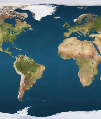
Deutsch: Positionskarte des Atlantischen Ozeans
Quadratische Plattkarte. Geographische Begrenzung der Karte:
English: Location map of the Atlantic Ocean
Equirectangular projection. Geographic limits of the map:
|
||
| Date | |||
| Soorce | Ain wirk, using file:Earthmap1000x500compac.jpg | ||
| Author | NordNordWest | ||
| Permission (Reuisin this file) |
|

|
This map has been made or improved in the German Kartenwerkstatt (Map Lab). You can propose maps to improve as well.
|
File history
Clap oan ae date/time fer tae see the file aes it kithed at that time.
| Date/Time | Thummnail | Dimensions | Uiser | Comment | |
|---|---|---|---|---|---|
| current | 14:11, 23 December 2009 | | 403 × 475 (159 KB) | NordNordWest | == {{int:filedesc}} == {{Information |Description= {{de|Positionskarte des Atlantischen Ozeans}} Quadratische Plattkarte. Geographische Begrenzung der Karte: * N: 90° N * S: 81° S * W: 100° W * O: 45° O {{en|Location map of |
Eimage airtins
The follaein pages airts tae this image:
Global file uisage
The follaein ither wikis uise this file:
- Uisage on da.wikipedia.org
- Uisage on de.wikipedia.org
- Uisage on en.wikipedia.org
- Uisage on fa.wikipedia.org
- Uisage on fr.wikipedia.org
- Mer des Caraïbes
- Bataille du 13 prairial an II
- Bataille du Rio de la Plata
- Guerre des Malouines
- Tenerife
- São Jorge (île)
- Séisme de Lisbonne
- Saint-Pierre et Saint-Paul (rochers)
- Petites Antilles
- Moustique (île)
- Carriacou
- Îles Orcades du Sud
- Bataille de St George's Caye
- Koltur
- Amelia Island
- Bataille du Cap-Vert
- Île Saint David
- Côte des Esclaves
- Invasions britanniques
- Bataille de Santa Cruz de Tenerife
- Île du Grand Connétable
- Bataille d'Ouessant (1778)
- Modèle:Géolocalisation/Océan Atlantique
- Malouine orientale
- Île de Madère
- Île Thompson (île fantôme)
- Elobey Chico
- Séisme de 1969 au Maroc
- Breiðafjörður
- Grande Canarie
- Bataille de Cabañas
- Cap Saint-Vincent (Portugal)
- Île Morpion
- Côte des Squelettes
- Invasion de la Guadeloupe (1794)
- Combat du 6 novembre 1794
- Archipel de Los Frailes
- Prise de la Martinique (1794)
- Town Hill
- Bataille de Rio de Janeiro (1710)
- Bataille de Rio de Janeiro (1711)
- Siège de Colonia del Sacramento
- Siège de la Guadeloupe (1703)
- Raid sur Nassau
- Capture du San Joaquin
- Fernando de Noronha (île)
View mair global usage o this file.