File:Achemenids500BC.png

Size o this luikower: 800 × 511 pixels. Ither resolutions: 320 × 205 pixels | 640 × 409 pixels | 1,020 × 652 pixels.
Oreeginal file (1,020 × 652 pixels, file size: 27 KB, MIME type: image/png)
Ootline
| Descreeption |
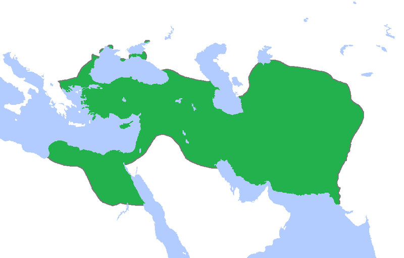
English: Locator map of the Persian Empire, c. 500 BC.
(Partially based on Atlas of World History (2007) - The World 750-500 BC, map) |
| Date | |
| Soorce | Ain wirk |
| Author | Gabagool |
Licensin
I, the copyright holder of this work, hereby publish it under the following license:
This file is licensed under the Creative Commons Attribution 3.0 Unported license.
- Ye are free:
- tae share – tae copy, distribute an transmit the wirk
- tae remix – tae adapt the wirk
- Unner the follaein condeetions:
- attribution – Ye must attribute the wirk in the manner specified bi the author or licensor (but nae in ony way that suggests that thay endorse ye or yer uise o the wirk).
File history
Clap oan ae date/time fer tae see the file aes it kithed at that time.
| Date/Time | Thummnail | Dimensions | Uiser | Comment | |
|---|---|---|---|---|---|
| current | 23:54, 11 Juin 2017 | | 1,020 × 652 (27 KB) | LouisAragon | rv sock. |
| 23:39, 11 November 2015 |  | 1,020 × 652 (20 KB) | History of Persia | look at the reference page for the wikipedia article Achaemenid Arabia. Look at the maps of Gandhara and Sogdia. | |
| 00:36, 14 October 2015 |  | 1,020 × 652 (27 KB) | LouisAragon | Constant hoax additions by HistoryofPersia. Only the addition of Macedon and those parts of Arabia were correct, the rest is all historical hoax. | |
| 23:42, 11 October 2015 |  | 1,020 × 652 (20 KB) | History of Persia | Macedonia | |
| 18:18, 23 September 2015 |  | 1,020 × 652 (20 KB) | LouisAragon | Even if it was true, we dont have a source for it. Its too much theorycrafting. | |
| 23:31, 8 September 2015 |  | 1,012 × 648 (19 KB) | History of Persia | More accurate map. info on greek territories: File:Map Greco-Persian Wars-en.svg, size of Mascat (modern Oman/UAE): File:East-Hem 600bc.jpg. clay tablets in old persian have been found in bahrain, so its likely they were part of the achaemenid empire | |
| 00:52, 29 Julie 2015 |  | 1,020 × 652 (20 KB) | History of Persia | They controlled arabia petrea. see the wikipedia article: achaemenid arabia. They also conquered the amyrgioi (see: Wars of darius I) | |
| 06:23, 14 Februar 2013 |  | 1,020 × 652 (27 KB) | TRAJAN 117 | Cropped again | |
| 06:17, 14 Februar 2013 |  | 1,020 × 902 (35 KB) | TRAJAN 117 | Cropped | |
| 15:50, 23 Apryle 2009 |  | 1,481 × 902 (50 KB) | Gabagool | {{Information |Description={{en|1=Locator map of the Persian Empire, c. 500 BC. (Partially based on ''Atlas of World History'' (2007) - The World 750-500 BC, map)}} |Source=Own work by uploader |Author=Gabagool / Jarle Grøhn |Date=2009 |
Eimage airtins
The follaein pages airts tae this image:
Global file uisage
The follaein ither wikis uise this file:
- Uisage on en.wikipedia.org
- Uisage on he.wiktionary.org
- Uisage on hu.wikipedia.org