File:İzmit nightly view.jpg

Size o this luikower: 800 × 433 pixels. Ither resolutions: 320 × 173 pixels | 640 × 346 pixels | 1,024 × 554 pixels | 1,600 × 866 pixels.
Oreeginal file (1,600 × 866 pixels, file size: 386 KB, MIME type: image/jpeg)
Ootline
| Descreeption |
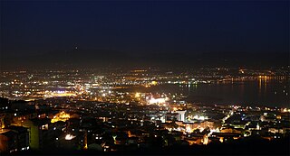
English: Gulf of İzmit |
| Date | |
| Soorce | Ain wirk |
| Author | Berkman Lord Gülenç |
| Camera location | | View this and other nearby images on: OpenStreetMap |
|---|
Licensin
I, the copyright holder of this work, hereby publish it under the following license:
This file is licensed under the Creative Commons Attribution 3.0 Unported license.
- Ye are free:
- tae share – tae copy, distribute an transmit the wirk
- tae remix – tae adapt the wirk
- Unner the follaein condeetions:
- attribution – Ye must attribute the wirk in the manner specified bi the author or licensor (but nae in ony way that suggests that thay endorse ye or yer uise o the wirk).
File history
Clap oan ae date/time fer tae see the file aes it kithed at that time.
| Date/Time | Thummnail | Dimensions | Uiser | Comment | |
|---|---|---|---|---|---|
| current | 15:08, 15 Mey 2011 | | 1,600 × 866 (386 KB) | Berkman | {{Information |Description ={{en|1=Gulf of İzmit}} |Source ={{own}} |Author =Berkman |Date =2007-05-09 |Permission = |other_versions = }} {{Location|40|46|18.39|N|29|55|30.59|E|region:TR}} |
Eimage airtins
The follaein pages airts tae this image:
Global file uisage
The follaein ither wikis uise this file:
- Uisage on ba.wikipedia.org
- Uisage on ca.wikipedia.org
- Uisage on ceb.wikipedia.org
- Uisage on de.wikipedia.org
- Uisage on fi.wikipedia.org
- Uisage on hu.wikipedia.org
- Uisage on incubator.wikimedia.org
- Uisage on it.wikipedia.org
- Uisage on ka.wikipedia.org
- Uisage on lt.wikipedia.org
- Uisage on sh.wikipedia.org
- Uisage on so.wikipedia.org
- Uisage on tl.wikipedia.org
- Uisage on tt.wikipedia.org
- Uisage on uk.wikipedia.org
- Uisage on vep.wikipedia.org
- Uisage on vi.wikipedia.org
- Uisage on www.wikidata.org