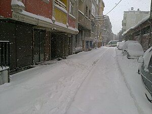
Sultangazi
Sultangazi is ane o Istanbul's new destricts. It wis foondit in 2009 for "New Local Govrenment Law" in Istanbul, Turkey.
Sultangazi | |
|---|---|
Destrict | |
 Location o Sultangazi in Istanbul, Turkey | |
| Coordinates: 41°12′57″N 28°44′05″E / 41.21583°N 28.73472°E[1] | |
| Kintra | Turkey |
| Province | Istanbul Province |
| Govrenment | |
| • Mayor | Cahit Altunay (AKP) |
| • Govrenor | Yusuf Ziya Çelikkaya |
| Population (2011) | |
| • Total | 483,225 |
| Time zone | UTC+2 (EET) |
| • Summer (DST) | UTC+3 (EEST) |
| Postal code | 34260, 34265, 34270 |
| Area code(s) | 0-212 |
| Website | www |

Esenler an Başakşehir are at wast, Gaziosmanpaşa is at sooth, an Eyüp is at north an east. Gaziosmanpaşa destrict wur dividit tae three destricts, Sultangazi is one o thaim an it's at obvious.
The TEM heich-gate draws tae border wi Gaziosmanpaşa.
Sultangazi is dividit intae three neebourheids: Habibler, Gazi an Sultançiftliği. The name o "Sultangazi" comes frae "Sultan" wird pairt o Sultançiftliği (meanin ferm o Sultan) an the neebourheid o Gazi.
This destrict's population is croudit, includes immigrants frae Bulgarie an Yugoslavie, an Black Sean Turkis populations. Kurdish minority an Alevi fowk exist in this destrict an aw, especially in Gazi neebourheid which commonly kent in Turkey wi 1995 riots.
Sultangazi haes 3 precincts, 11 neebourheids an 1 veelage.
- Precincts: Sultançiftliği, Gazi, Habibler
- Neebourheids: 50. Yıl, 75. Yıl, Cebeci, Cumhuriyet, Esentepe, İsmetpaşa, Malkoçoğlu, Uğur Mumcu, Yayla, Yunus Emre, Zübeyde Hanım
- Villages: Cebeci (near tae Cebeci neebourheid as 3 kilometres.)
See an aw eedit
References eedit
- ↑ a b c "İstanbul-İlçeler-Sultangazi" (in Turkish). İstanbul Net. Retrieved 15 October 2011.

