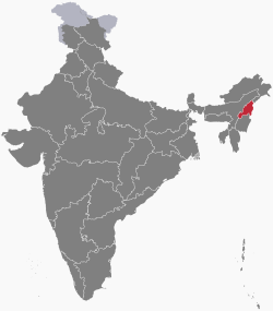
Nagaland
Nagaland /ˈnɑːɡəlænd/ is a state in Northeast Indie. It haes a aurie o 16,579 square kilometre (6,401 sq mi) wi a population o 1,980,602 per the 2011 Census o Indie, makkin it ane o the smawest states o Indie.[2]
Nagaland | |
|---|---|
 | |
| Coordinates (Kohima): 25°40′N 94°07′E / 25.67°N 94.12°ECoordinates: 25°40′N 94°07′E / 25.67°N 94.12°E | |
| KIntra | |
| Formation | 1 Dizember 1963† |
| Caipital | Kohima |
| Lairgest ceety | Dimapur |
| Destricts | 11 |
| Govrenment | |
| • Govrenor | Padmanabha Acharya |
| • Chief Meenister | Shürhozelie Liezietsu[1] |
| • Legislatur | Unicameral (60 seats) |
| • Pairlamentar constituency | Rajya Sabha 1 Lok Sabha 1 |
| • Heich Court | Gauhati Heich Court – Kohima Bench |
| Area | |
| • Total | 16579 km2 (6,401 sq mi) |
| Area rank | 26t |
| Population (2011) | |
| • Total | 1,980,602 |
| • Rank | 25t |
| • Density | 119/km2 (310/sq mi) |
| Time zone | UTC+05:30 (IST) |
| ISO 3166 code | IN-NL |
| HDI | |
| HDI rank | 4t (2005) |
| Leeteracy | 80.11% (13th) |
| Offeecial leid | Inglis |
| Website | nagaland.nic.in |
| †It was carved out from the state of Assam by the State of Nagaland Act, 1962 | |
| Ainimal | Methun |
|---|---|
| Bird | Blyth's tragopan (Tragopan blythii) |
References eedit
- ↑ "Shurhozelie Liezeitsu elected as new Nagaland CM". The Indian Express. Nagaland. 20 Februar 2017. Retrieved 20 Februar 2017.
- ↑ Census of India 2011 Govt of India
Freemit airtins eedit
- Offeecial wabsteid
- State Portal of the Government of Nagaland
- Nagaland travel guide frae Wikivoyage
| Wikimedia Commons haes media relatit tae Nagaland. |