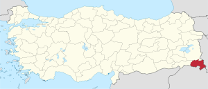
Hakkâri Province
Hakkâri Province (Turkis: Hakkâri ili) is a province in the sootheast corner o Turkey. The admeenistrative centre is locatit in the ceety o Hakkâri (Kurdish: Colemêrg). The province covers an aurie o 7,121 km² an haes a population o 251,302 (2010 est). The province haed a population o 236,581 in 2000.
Hakkâri Province Hakkâri ili | |
|---|---|
 Location of Hakkâri Province in Turkey | |
| Kintra | Turkey |
| Region | Eastren Anatolie |
| Govrenment | |
| • Electoral destrict | Hakkâri |
| Area | |
| • Tot | 7,121 km2 (2,749 sq mi) |
| Population (2010)[1] | |
| • Tot | 251,302 |
| • Density | 35/km2 (91/sq mi) |
| Area code(s) | 0438 |
| Vehicle registration | 30 |
The province wis creatit in 1936 oot o pairt o the Van Province. Its adjacent provinces are the Şırnak tae the wast an the Van tae the north.
Destricts eedit
Hakkâri province is dividit intae 4 destricts (caipital destrict in bauld):
History eedit
The aurie haes been ruled bi Akkadians, Hittites, Assyrians, Babylon, Persians, Greeks, Armenians, Parthians, Roum, Byzantium, the Sassanids, Arabs, Kurds, an Mongols in its lang history.
References eedit
- ↑ Turkish Statistical Institute, MS Excel document – Population of province/district centers and towns/villages and population growth rate by provinces
Coordinates: 37°27′58″N 44°03′52″E / 37.46611°N 44.06444°E