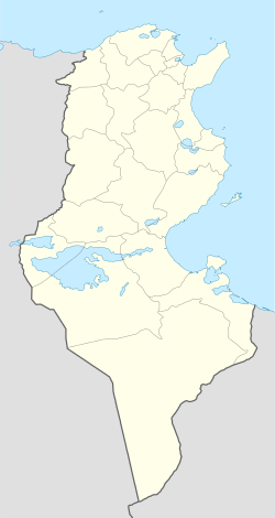
Gabès
Gabès (Arabic: قابس Qābis) is the caipital ceety o the Gabès Governorate, a province o Tunisie. Wi a population o 116,323 (census 2004) it is the 6t lairgest Tunisian ceety.
Gabès قابس | |
|---|---|
| Coordinates: 33°53′N 10°07′E / 33.883°N 10.117°E | |
| Kintra | Tunisia |
| Govrenorates | Gabès |
| Population (2004) | |
| • Total | 116,323 |
| Soorce: Census | |
| Time zone | UTC+1 (CET) |
| • Summer (DST) | UTC+2 (CEST) |
| Website | Official website |
History eedit
Gabès wis an integral ceety in the territory o Carthage. Follaein the Seicont Punic War in the 2nt century BC Gabès came unner Roman control wi a new name Tacape.
- 7t century: The Muslim conquest (Al'Fatah Al'Islami). Muhammed's companion Sidi Abou Loobaba Al'Ansarey settles in Gabès.
- 1881: Gabès comes unner a French protectorate.
- 1940: Follaein the Fall o Fraunce, Gabès comes unner German control.
- 1943: Gabès returns tae French control wi the help o the Breetish (in the Mareth Line). The operation results in serious damage tae the ceety infrastructure.
- 1945: The rebiggin o Gabès stairts.
- 1956: Gabès reverts tae Tunisian control wi the unthirldom o Tunisie frae the French.
Education eedit
Economy eedit
Gabès is ane o the biggest industrial ceeties in Tunisie. Maist industries are chemical orientit, this is why the ceety affers ane o the best chemistry degrees in Africae frae the University o Gabès. The main industries are:
- Cement
- Chemical products
- Brick Factories
- Oil refinery
The fast growin nummers o factories haes resultit in fairly serious pollution o the aurie an Gulf o Gabès. In recent years the govrenment is wirkin on new programs an laws tae decrease the amount o pollution.
Transport eedit
Railways eedit
Gabès is terminus o a nairae gauge 1,000 mm (3 ft 3 3⁄8 in) branch railwey frae the caipital, an is the nearest railwey station tae the Libyan border at Ras Ejder. Gabès haes an aa ane o the biggest ports in Tunisie; it is uised uisually tae ship the mineral products frae the ceety o Gafsa.
Roads eedit
Gabès will be linked suin wi the naitional motorwey A4 ( Tunis - Ras Jdir )
Climate eedit
Gabes haes a warm-simmer Mediterranean climate, characterized bi a het an dry saison an a cuil an arid saison.
| Climate data for Gabes | |||||||||||||
|---|---|---|---|---|---|---|---|---|---|---|---|---|---|
| Month | Jan | Feb | Mar | Apr | May | Jun | Jul | Aug | Sep | Oct | Nov | Dec | Year |
| Record heich °C (°F) | 27 (81) |
31 (88) |
37 (99) |
42 (108) |
43 (109) |
46 (115) |
50 (122) |
47 (117) |
49 (120) |
44 (111) |
36 (97) |
27 (81) |
50 (122) |
| Average heich °C (°F) | 16 (61) |
18 (64) |
21 (70) |
23 (73) |
26 (79) |
28 (82) |
32 (90) |
33 (91) |
31 (88) |
27 (81) |
22 (72) |
17 (63) |
24 (75) |
| Average law °C (°F) | 6 (43) |
7 (45) |
9 (48) |
12 (54) |
16 (61) |
19 (66) |
22 (72) |
22 (72) |
21 (70) |
17 (63) |
11 (52) |
7 (45) |
13 (55) |
| Record law °C (°F) | −3 (27) |
−2 (28) |
2 (36) |
4 (39) |
4 (39) |
6 (43) |
9 (48) |
14 (57) |
12 (54) |
6 (43) |
1 (34) |
0 (32) |
−3 (27) |
| Average precipitation mm (inches) | 23 (0.9) |
18 (0.7) |
20 (0.8) |
10 (0.4) |
8 (0.3) |
0 (0) |
0 (0) |
3 (0.1) |
13 (0.5) |
31 (1.2) |
31 (1.2) |
15 (0.6) |
172 (6.8) |
| Source: BBC Weather [1] | |||||||||||||
Tourism eedit
Owerview eedit
Gabès is famous for its traditional Souqs in Jarah; it is an aa kent for its attractive beach an the unuisual seaside oasis (Gabes is locatit on the coast o the Mediterranean Sea). The best pairts o the beach are in the sooth o the ceety (Road tae Djerba). The best ane is the Lemawa or Lemaya beach. The govrenment is plannin tae big a tourist zone thare in the comin years. Gabès haes a unique featur in the warld, in this ceety ye fynd the muntain, the sea, the oasis an the desert. The maist visitit place in Gabès is the toun Matmata.
Place tae veesit:
- The tradeetional souks.
- The Kornich.
- Sidi Boulbaba.
- The Mouradi schuil.
- Zaouia Sidi Ahmed Toujani.
Warld Heritage Status eedit
This site wis addit tae the UNESCO Warld Heritage Tentative List on Mey 28, 2008, in the Cultural category[2].
See an aa eedit
- Gabès Governorate, ane o the twintie-fower governorates (provinces) o Tunisie
- Gulf o Gabès
- University o Gabès, a public varsity
References eedit
- ↑ "Average Conditions Gabes, Tunisia". BBC Weather. Archived frae the original on 7 Apryle 2007. Retrieved 15 October 2010.
- ↑ Oasis de Gabès - UNESCO World Heritage Centre
Freemit airtins eedit
| Wikimedia Commons haes media relatit tae Gabès. |
- Gabès official website Archived 2010-04-12 at the Wayback Machine
- "Gabès: Oasis on the Sea" from Lexicorient Archived 2012-10-30 at the Wayback Machine
