File:Stirling UK relief location map.jpg
Size o this luikower: 583 × 600 pixels. Ither resolutions: 233 × 240 pixels | 467 × 480 pixels | 747 × 768 pixels | 996 × 1,024 pixels | 2,002 × 2,059 pixels.
Oreeginal file (2,002 × 2,059 pixels, file size: 675 KB, MIME type: image/jpeg)
| Descreeption |
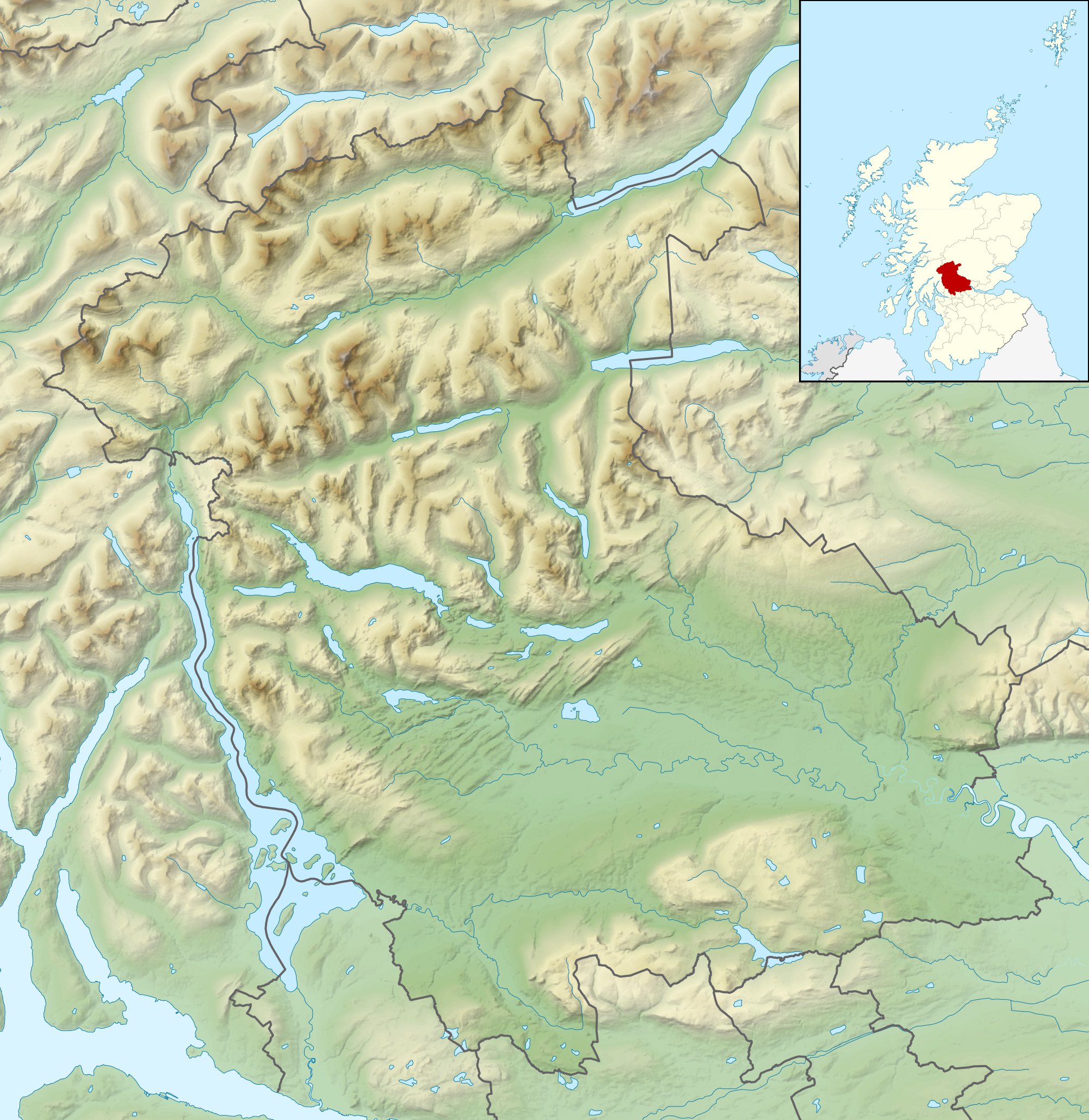
Relief map of Stirling, UK. Equirectangular map projection on WGS 84 datum, with N/S stretched 175% Geographic limits:
|
| Date | |
| Soorce |
|
| Author | Nilfanion, created using Ordnance Survey data |
| Permission (Reuisin this file) |
This file is licensed unner the Creative Commons Attribution-Share Alike 3.0 Unported license. Attribution: Contains Ordnance Survey data © Crown copyright and database right
|
| Other versions | File:Stirling UK blank map.svg - Blank map |
File history
Clap oan ae date/time fer tae see the file aes it kithed at that time.
| Date/Time | Thummnail | Dimensions | Uiser | Comment | |
|---|---|---|---|---|---|
| current | 12:31, 30 November 2011 | | 2,002 × 2,059 (675 KB) | Nilfanion | {{Information |Description=Relief map of Stirling, UK. Equirectangular map projection on WGS 84 datum, with N/S stretched 175% Geographic limits: *West: 4.90W *East: 3.76W *North: 56.60N *South: 55.93N |Source=[[w:Ordnance Survey|Ordnance |
Eimage airtins
The follaein pages airts tae this image:
Global file uisage
The follaein ither wikis uise this file:
- Uisage on ar.wikipedia.org
- Uisage on bg.wikipedia.org
- Uisage on ceb.wikipedia.org
- Uisage on de.wikipedia.org
- Ben Lomond (Schottland)
- Stirling Castle
- Loch Katrine
- Dumyat
- Doune Castle
- Ben Ledi
- Loch Achray
- Loch Ard
- Loch Chon
- Loch Drunkie
- Vorlage:Positionskarte Schottland Stirling
- Culcreuch Castle
- Loch Venachar
- Falls of Dochart
- Castle Menzies
- Lake of Menteith
- Inchbuie
- Inchcailloch
- Loch Lubnaig
- Loch Voil
- Ben Vorlich (Loch Earn)
- Stùc a’ Chroin
- Ben More (Crianlarich)
- Stob Binnein
- Cruach Ardrain
- Beinn Tulaichean
- An Caisteal
- Beinn a’ Chroin
- Beinn Chabhair
- Ben Oss
- Beinn Dubhchraig
- Ben Challum
- Meall Glas
- Sgiath Chùil
- Falls of Falloch
- Mugdock Castle
- Plean Castle
- Loch Arklet
- Dubh Lochan
- Uisage on en.wikipedia.org
View mair global usage o this file.