File:Location map Mexico Oaxaca.png

Size o this luikower: 800 × 600 pixels. Ither resolutions: 320 × 240 pixels | 640 × 480 pixels | 960 × 720 pixels.
Oreeginal file (960 × 720 pixels, file size: 270 KB, MIME type: image/png)
| Descreeption |
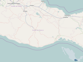
English: Map of Oaxaca
Geographic limits of the map:
This file is licensed under the Creative Commons Attribution-Share Alike 2.0 Generic license.
|
| Soorce | OpenStreetMap |
| Author | Dr. Blofeld |
File history
Clap oan ae date/time fer tae see the file aes it kithed at that time.
| Date/Time | Thummnail | Dimensions | Uiser | Comment | |
|---|---|---|---|---|---|
| current | 18:58, 8 Mey 2010 | | 960 × 720 (270 KB) | Dr. Blofeld~commonswiki |
Eimage airtins
The follaein pages airts tae this image:
Global file uisage
The follaein ither wikis uise this file:
- Uisage on ar.wikipedia.org
- Uisage on bg.wikipedia.org
- Uisage on ceb.wikipedia.org
- Uisage on en.wikipedia.org
- Juchitán de Zaragoza
- Oaxaca International Airport
- Bahías de Huatulco International Airport
- Puerto Escondido International Airport
- Salina Cruz Airport
- San Mateo Río Hondo
- Ixtepec, Oaxaca
- Santa María del Tule
- Oaxaca Valley
- Chivela Pass
- Tlaxiaco
- Huautla de Jiménez
- Yagul
- Ayotzintepec
- La Compañía, Oaxaca
- Magdalena Jaltepec
- Magdalena Peñasco
- Nejapa de Madero
- La Pe
- San José Independencia
- Tataltepec de Valdés
- Santa María Coyotepec
- Santa María Tlahuitoltepec
- Santiago Matatlán
- Lake Miguel Alemán
- Module:Location map/data/Mexico Oaxaca/doc
- Pochutla District
- 1999 Oaxaca earthquake
- Aditnalta
- 2018 Oaxaca earthquake
- Ixtepec Airport
- Module:Location map/data/Mexico Oaxaca
- La Ventosa
- 2018–19 Liga TDP season
- User:Ty654/List of earthquakes from 1900-1949 exceeding magnitude 7+
- User:Ty654/List of earthquakes from 1950-1999 exceeding magnitude 7+
- User:Ty654/List of earthquakes from 2000-present exceeding magnitude 7+
- User:Ty654/List of earthquakes from 1910-1919 exceeding magnitude 6+
- User:Ty654/List of earthquakes from 1930-1939 exceeding magnitude 6+
- User:Ty654/List of earthquakes from 1940-1949 exceeding magnitude 6+
- User:Ty654/List of earthquakes from 1950-1954 exceeding magnitude 6+
View mair global usage o this file.