File:Austria Styria adm location map.svg

Oreeginal file (SVG file, nominallie 1,199 × 852 pixels, file size: 637 KB)
Ootline
| Descreeption |
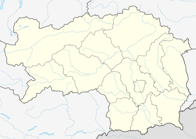
Deutsch: Positionskarte der Steiermark, Österreich
English: Location map of Styria, Austria
|
||||||||||||
| Date | |||||||||||||
| Soorce |
Own work using:
|
||||||||||||
| Author | NordNordWest | ||||||||||||
| Other versions |
|
||||||||||||
| SVG genesis | This locator map was created with Adobe Illustrator.
|
||||||||||||
_adm_location_map.svg)

Licensin
Usage of this file with:

explanatory notes: Legally binding is only the full legalcode. For a free usage I recommend to respect the following licence conditions:
1. Provide my name as given above: NordNordWest,
2. a copy of, or the URI for, the applicable license: https://creativecommons.org/licenses/by-sa/3.0/de/legalcode,
3. the title of the work,
4. in the case of an adaptation, a credit identifying the use of the work in the adaptation.
This license and the rights granted hereunder will terminate automatically upon any breach by you of the terms of this license. Any of the above conditions can be waived if you get permission from the copyright holder. If you have questions or wish differing conditions, please contact me through nnwest or my discussion page ![]() t-online.de
t-online.de
- Ye are free:
- tae share – tae copy, distribute an transmit the wirk
- tae remix – tae adapt the wirk
- Unner the follaein condeetions:
- attribution – Ye must attribute the wirk in the manner specified bi the author or licensor (but nae in ony way that suggests that thay endorse ye or yer uise o the wirk).
- share alik – If ye alter, transform, or big upon this wirk, ye mey distribute the resultin wirk anly unner the same or seemilar license tae this ane.

File history
Clap oan ae date/time fer tae see the file aes it kithed at that time.
| Date/Time | Thummnail | Dimensions | Uiser | Comment | |
|---|---|---|---|---|---|
| current | 15:46, 30 December 2019 | | 1,199 × 852 (637 KB) | NordNordWest | upd |
| 12:20, 1 Januar 2015 |  | 1,199 × 852 (626 KB) | NordNordWest | == {{int:filedesc}} == {{Information |Description= {{de|1=Positionskarte der Steiermark, Österreich}} {{en|1=Location map of Styria, Austria}} {{Location map series N |stretching=– |top=47.8849333 |bottom=46.57305 |left=13.5085305 |right=16.2235138... |
Eimage airtins
The follaein pages airts tae this image:
Global file uisage
The follaein ither wikis uise this file:
- Uisage on de.wikipedia.org
- Heilbrunn (Gemeinde Anger)
- Flughafen Graz
- Frauenmauerhöhle
- Katerloch
- Schwarzmooskogel-Höhlensystem
- Gruabn
- Grasslhöhle
- Hüttstatthöhle
- Franz-Fekete-Stadion
- DÖF-Sonnenleiter-Höhlensystem
- Grubstein-Westwandhöhle
- Merkur Arena (Graz)
- Tierwelt Herberstein
- Südwandhöhle
- Benutzer:Tigerente/Baustelle
- Shopping City Seiersberg
- Eisstadion Graz-Liebenau
- Ski amadé
- Rettenwandhöhle
- Kraushöhle
- Drachenhöhle bei Mixnitz
- Odelsteinhöhle
- Badlhöhle
- Lurgrotte
- Repolusthöhle
- Dampfkraftwerk Voitsberg
- Schönberg-Höhlensystem
- Sportzentrum Zeltweg
- Panoramastadion (Bad Aussee)
- Wassermannsloch
- KLH-Arena
- Tauernwindpark
- Leoben City Shopping
- Vorlage:Positionskarte Österreich Steiermark
- Räuberhöhle (Spital am Semmering)
- Profertil Arena Hartberg
- Skigebiet Dachsteingletscher
- Krankenhaus der Elisabethinen Graz
- Einkaufszentrum Murpark
- Böhler Bleche
- Sportstadion Marktgemeinde Gratkorn
- Dekanat Graz-Mitte
- Dekanat Graz-Nord
- Fernheizkraftwerk Neudorf-Werndorf
- Flugplatz Fürstenfeld
- Flugplatz Niederöblarn
- Rechenbrücke
- Österreichische Fußballmeisterschaft 2012/13
- Gas- und Dampfkraftwerk Mellach
View mair global usage o this file.