File:Australia Northern Territory relief location map.png

Size o this luikower: 431 × 599 pixels. Ither resolutions: 172 × 240 pixels | 345 × 480 pixels | 552 × 768 pixels | 736 × 1,024 pixels | 1,339 × 1,862 pixels.
Oreeginal file (1,339 × 1,862 pixels, file size: 802 KB, MIME type: image/png)
Ootline
| Descreeption |
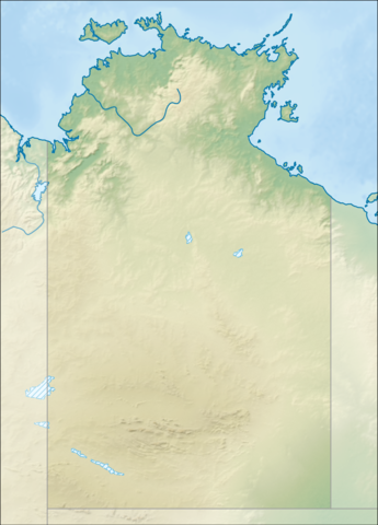
Relief location map of the Northern Territory, Australia Equidistant cylindrical projection, latitude of true scale 17.75° S (equivalent to equirectangular projection with N/S stretching 105 %). Geographic limits of the map:
|
| Date | |
| Soorce |
|
| Author | Tentotwo |

|
This map has been made or improved in the German Kartenwerkstatt (Map Lab). You can propose maps to improve as well.
|
Licensin
I, the copyright holder of this work, hereby publish it under the following license:
This file is licensed unner the Creative Commons Attribution-Share Alike 3.0 Unported license.
- Ye are free:
- tae share – tae copy, distribute an transmit the wirk
- tae remix – tae adapt the wirk
- Unner the follaein condeetions:
- attribution – Ye must attribute the wirk in the manner specified bi the author or licensor (but nae in ony way that suggests that thay endorse ye or yer uise o the wirk).
- share alik – If ye alter, transform, or big upon this wirk, ye mey distribute the resultin wirk anly unner the same or seemilar license tae this ane.
File history
Clap oan ae date/time fer tae see the file aes it kithed at that time.
| Date/Time | Thummnail | Dimensions | Uiser | Comment | |
|---|---|---|---|---|---|
| current | 18:01, 2 Februar 2013 | | 1,339 × 1,862 (802 KB) | Tentotwo | User created page with UploadWizard |
Eimage airtins
The follaein pages airts tae this image:
Global file uisage
The follaein ither wikis uise this file:
- Uisage on als.wikipedia.org
- Uisage on azb.wikipedia.org
- Uisage on ban.wikipedia.org
- Uisage on bg.wikipedia.org
- Uisage on ceb.wikipedia.org
- Uisage on da.wikipedia.org
- Uisage on de.wikipedia.org
- Uluru
- Kakadu-Nationalpark
- Kata Tjuṯa
- Ranger-Uran-Mine
- Litchfield-Nationalpark
- Mount Conner
- West-MacDonnell-Nationalpark
- Uluṟu-Kata-Tjuṯa-Nationalpark
- MacDonnell Ranges
- Watarrka-Nationalpark
- Henbury (Meteorit)
- Bathurst Island (Australien)
- Bremer Island
- Port Essington
- Kings Canyon (Australien)
- Tiwi Islands
- Finke-Gorge-Nationalpark
- Nitmiluk-Nationalpark
- Garig-Gunak-Barlu-Nationalpark
- Wessel-Inseln
- Lake Bennett (Australien)
- Vorlage:Positionskarte Australien Northern Territory
- Boxhole-Krater
- Wikipedia:Kartenwerkstatt/Positionskarten/Australien und Ozeanien
- Gregory-Nationalpark
- Keep-River-Nationalpark
- Charles-Darwin-Nationalpark
- Barranyi-(North-Island)-Nationalpark
- Davenport-Range-Nationalpark
View mair global usage o this file.