File:Albania District.svg

Size of this PNG preview of this SVG file: 304 × 600 pixels. Ither resolutions: 121 × 240 pixels | 243 × 480 pixels | 389 × 768 pixels | 519 × 1,024 pixels | 1,038 × 2,048 pixels | 508 × 1,002 pixels.
Oreeginal file (SVG file, nominallie 508 × 1,002 pixels, file size: 276 KB)
| Descreeption |
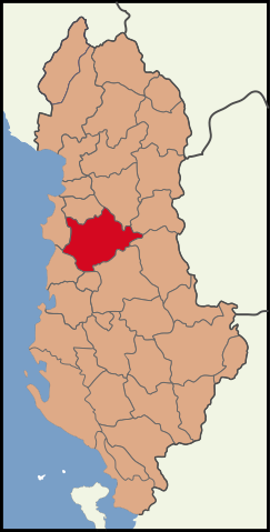
English: Albania location Tirana County.
Blank map of the districts of Albania, useful for numbering/labelling for other languages. |
||
| Date | (UTC) | ||
| Soorce | |||
| Author |
|
||
| SVG genesis | This W3C-invalid map was created with Adobe Illustrator.
|
This file is licensed unner the Creative Commons Attribution-Share Alike 3.0 Unported license.
- Ye are free:
- tae share – tae copy, distribute an transmit the wirk
- tae remix – tae adapt the wirk
- Unner the follaein condeetions:
- attribution – Ye must attribute the wirk in the manner specified bi the author or licensor (but nae in ony way that suggests that thay endorse ye or yer uise o the wirk).
- share alik – If ye alter, transform, or big upon this wirk, ye mey distribute the resultin wirk anly unner the same or seemilar license tae this ane.
Original upload log
This image is a derivative work of the following images:
- File:Albania location Tirana.svg licensed with Cc-by-3.0
- 2010-03-30T16:55:33Z The Emirr 508x1002 (201332 Bytes) {{Information |Description={{en|1=Albania location Tirana County.}} |Source={{own}} |Author={{click|image=TheEmirr-Logo.png|link=User:The Emirr|width=60px|height=60px}} |Date=2010-03-30 |Permission={{The Emirr}} |other_versio
- File:Albania districts.svg licensed with Cc-by-2.5, Cc-by-sa-3.0-migrated, GFDL
- 2011-05-07T19:36:03Z Malyszkz 1000x2112 (113600 Bytes) change border size
- 2011-05-07T18:46:45Z Malyszkz 1000x2112 (113609 Bytes) {{Information |Description=Blank map of the districts of Albania, useful for numbering/labelling for other languages. |Source=*[[:File:Albania_districts_blank_2.svg|]] |Date=2011-05-07 18:46 (UTC) |Author=*[[:File:Albania_dis
Uploaded with derivativeFX
File history
Clap oan ae date/time fer tae see the file aes it kithed at that time.
| Date/Time | Thummnail | Dimensions | Uiser | Comment | |
|---|---|---|---|---|---|
| current | 12:18, 8 Mey 2011 | | 508 × 1,002 (276 KB) | Vinie007 | color fix |
| 12:00, 8 Mey 2011 |  | 508 × 1,002 (276 KB) | Malyszkz | {{Information |Description={{en|1=Albania location Tirana County.}} Blank map of the districts of Albania, useful for numbering/labelling for other languages. |Source=*File:Albania_location_Tirana.svg *File:Albania_districts.svg |Date=2011-05- |
Eimage airtins
The follaein pages airts tae this image:
Global file uisage
The follaein ither wikis uise this file:
- Uisage on dv.wikipedia.org
- Uisage on en.wikipedia.org
- Uisage on fa.wikipedia.org
- Uisage on incubator.wikimedia.org
- Uisage on lt.wikipedia.org
- Uisage on nap.wikipedia.org
- Uisage on pa.wikipedia.org
- Uisage on pnt.wikipedia.org
- Uisage on rm.wikipedia.org
- Uisage on ru.wikipedia.org
- Uisage on simple.wikipedia.org
- Uisage on sq.wikipedia.org
- Uisage on sr.wikipedia.org
- Uisage on ti.wikipedia.org
- Uisage on vi.wikipedia.org