File:Afghanistan-Nimruz.png
Nae heier resolution available.
Afghanistan-Nimruz.png (300 × 230 pixels, file size: 9 KB, MIME type: image/png)
Ootline
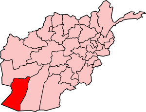
Map of Afghanistan showing Nimruz province. Made by User:Golbez, based on original map by Morwen on en.wikipedia.
Licensin

|
Permission is grantit tae copy, distribute an/or modify this document unner the terms o the GNU Free Documentation License, Version 1.2 or ony later version published bi the Free Software Foundation; wi no Invariant Sections, no Front-Cover Texts, an no Back-Cover Texts. A copy o the license is includit in the section enteetled GNU Free Documentation License. |
| This file is licensed unner the Creative Commons Attribution-Share Alike 3.0 Unported license. | ||
| ||
| This licensing tag was added to this file as part of the GFDL licensing update. |
File history
Clap oan ae date/time fer tae see the file aes it kithed at that time.
| Date/Time | Thummnail | Dimensions | Uiser | Comment | |
|---|---|---|---|---|---|
| current | 04:54, 29 September 2005 | | 300 × 230 (9 KB) | Golbez | Map of Afghanistan showing Nimruz province. Made by User:Golbez, based on original map by Morwen on en.wikipedia. ==Licensing== {{self|cc-by-2.5}} |
Eimage airtins
The follaein pages airts tae this image:
Global file uisage
The follaein ither wikis uise this file:
- Uisage on ar.wikipedia.org
- Uisage on be.wikipedia.org
- Uisage on bn.wikipedia.org
- Uisage on cy.wikipedia.org
- Uisage on en.wikipedia.org
- Chakhansur District
- Chahar Burjak District
- Kang District
- Khash Rod District
- Dasht-e Margo
- Template:Nimruz-geo-stub
- Delaram
- Zaranj District
- Chakhansur (village)
- Istoway
- 2011 Nimruz province bombing
- Dasht-e Khash
- Delaram District
- Ghorghori
- Khash, Nimruz
- Lukhi, Khash Rod
- Khunia
- Shishawa
- Mazad village
- Razi Balochi
- Dasht-e Shesh Ābeh
- Uisage on fa.wikipedia.org
- Uisage on hi.wikipedia.org
- Uisage on incubator.wikimedia.org
- Uisage on ko.wikipedia.org
- Uisage on mzn.wikipedia.org
- Uisage on pnb.wikipedia.org
- Uisage on ps.wikipedia.org
- Uisage on pt.wikipedia.org
- Uisage on su.wikipedia.org
- Uisage on tg.wikipedia.org
- Uisage on tr.wikipedia.org
View mair global usage o this file.